LC Subject Heading: Pejepscot Company--Records and correspondence
- Historical Items (50)
- Tax Records (0)
- Architecture & Landscape (0)
- Online Exhibits (0)
- Site Pages (0)
- My Maine Stories (0)
- Lesson Plans (0)
Historical Items
These results include photographs, documents, letters, paintings, artifacts, and many other kinds of Maine related items from collections around the state and elsewhere.
Item 102252

Plan of burial ground, Minot, ca. 1835
Contributed by: Maine Historical Society Date: 1835 Location: Minot Media: Ink on paper
Item 102068

"Tract of land lying in Poland," 1798
Contributed by: Maine Historical Society Date: 1798 Location: Auburn; Poland; Minot; Turner Media: Ink on paper
Item 11923

Survey of Robert and John Donlop lots, Brunswick, 1757
Contributed by: Maine Historical Society Date: 1757 Location: Brunswick Media: Ink on paper
Item 11924

Lots on Maquoit Road, Brunswick, 1761
Contributed by: Maine Historical Society Date: 1761 Location: Brunswick Media: Ink on paper
Item 11925

Seven lots on the Androscoggin River, 1771
Contributed by: Maine Historical Society Date: 1771 Location: Brunswick; Topsham; Freeport; Durham Media: Ink on paper
Item 11926
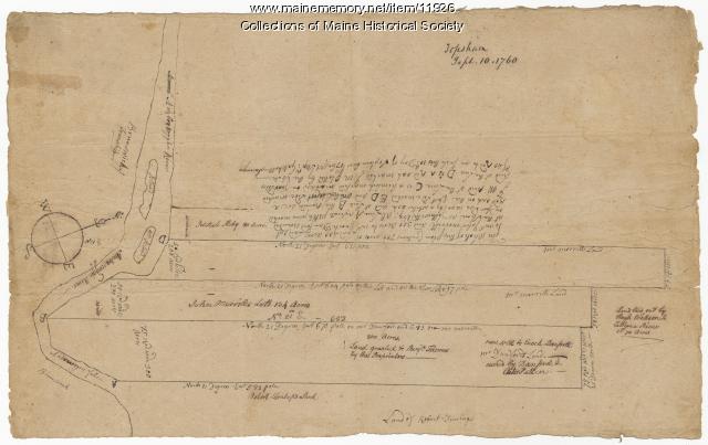
Morrill and Danforth lots, Topsham, 1760
Contributed by: Maine Historical Society Date: 1760-09-10 Location: Topsham Media: Ink on paper
Item 11929
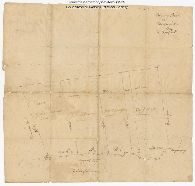
Flying Point at Maquoit Bay, Freeport, ca. 1770
Contributed by: Maine Historical Society Date: circa 1770 Location: Freeport; Brunswick Media: Ink on paper
Item 112089

Pejepscot Company Records, Volume 6, 1730-1821
Contributed by: Maine Historical Society Date: 1730–1821 Location: Boothbay Harbor; Bowdoinham; Brunswick; Harpswell Media: Ink on paper
Item 5960

Fort land for William Ross, Brunswick, ca. 1763
Contributed by: Maine Historical Society Date: circa 1763 Location: Brunswick Media: Ink on paper
Item 11714
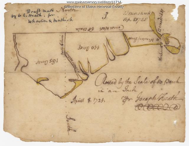
Contributed by: Maine Historical Society Date: 1725-04-08 Location: Brunswick Media: Ink on paper
Item 11715
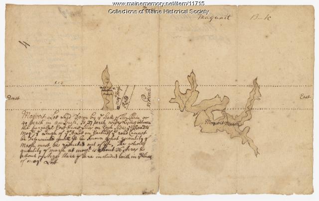
Plan of Maquoit Meadows, ca. 1720
Contributed by: Maine Historical Society Date: circa 1720 Location: Brunswick Media: Ink on paper
Item 11717

Contributed by: Maine Historical Society Date: circa 1718 Location: Brunswick; Harpswell; Bath; Topsham Media: Ink on paper
Item 11718

Contributed by: Maine Historical Society Date: circa 1740 Location: Brunswick Media: Ink on paper
Item 11719
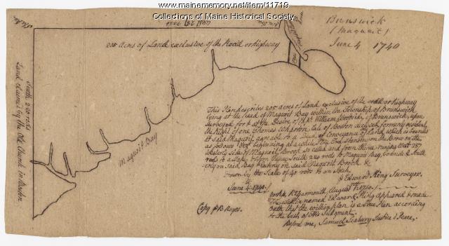
Contributed by: Maine Historical Society Date: 1740-06-04 Location: Brunswick Media: Ink on paper
Item 11720

Contributed by: Maine Historical Society Date: 1740-09-29 Location: Brunswick Media: Ink on paper
Item 11721

Plan of Land at Brunswick Narrows, 1741
Contributed by: Maine Historical Society Date: 1741 Location: Brunswick Media: Ink on paper
Item 11722

Map of Brunswick, lots on Merrymeeting Bay, ca. 1750
Contributed by: Maine Historical Society Date: circa 1750 Location: Brunswick Media: Ink on paper
Item 11723

Contributed by: Maine Historical Society Date: 1747-07-06 Location: Brunswick Media: Ink on paper
Item 11724

Map of Brunswick near the Narrows, 1737
Contributed by: Maine Historical Society Date: 1737 Location: Brunswick; Topsham Media: Ink on paper
Item 11725

Contributed by: Maine Historical Society Date: 1772 Location: Brunswick Media: Ink on paper
Item 11726

Contributed by: Maine Historical Society Date: 1795-05-29 Location: Brunswick; Durham; Freeport; Bath Media: Ink on paper
Item 11727

Cathance Millright's land, Topsham, 1759
Contributed by: Maine Historical Society Date: 1759-06-16 Location: Topsham Media: Ink on paper
Item 11728

Plan of a road in Brunswick, 1764
Contributed by: Maine Historical Society Date: 1764 Location: Brunswick; Bath Media: Ink on paper
Item 11729

Land surveyed for Hugh Wilson, Topsham, 1761
Contributed by: Maine Historical Society Date: 1761-01-01 Location: Topsham Media: Ink on paper
