Keywords: map
- Historical Items (939)
- Tax Records (0)
- Architecture & Landscape (209)
- Online Exhibits (33)
- Site Pages (232)
- My Maine Stories (8)
- Lesson Plans (6)
Historical Items
These results include photographs, documents, letters, paintings, artifacts, and many other kinds of Maine related items from collections around the state and elsewhere.
Item 7494

Map of New England and New York, ca. 1676
Contributed by: Maine Historical Society Date: circa 1676 Media: Ink on paper
Item 22489

Northern Maine boundary map, 1843
Contributed by: Maine Historical Society Date: 1843 Media: Ink on paper, map
Item 105630

Contributed by: Maine Historical Society Date: 1835 Media: Ink on paper
Item 11854

Moses Greenleaf's Map of the inhabited part of the state of Maine, 1829
Contributed by: Maine Historical Society Date: 1778 Media: Ink wash on lithograph, Map
Item 23348

Map showing approaches to Mount Desert, 1903
Contributed by: Maine Historical Society Date: 1903 Media: Ink on paper, map
Item 11714
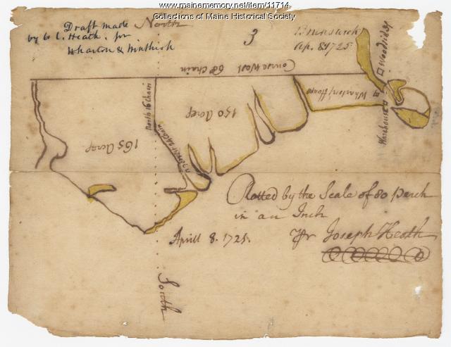
Contributed by: Maine Historical Society Date: 1725-04-08 Location: Brunswick Media: Ink on paper
Item 11726

Contributed by: Maine Historical Society Date: 1795-05-29 Location: Brunswick; Durham; Freeport; Bath Media: Ink on paper
Item 105269

Map of Maine drawn by Sarah N. Young, 1822
Contributed by: Osher Map Library and Smith Center for Cartographic Education Date: 1822 Media: Ink on Paper
Item 31883

Map of Cumberland County, 1880
Contributed by: North Yarmouth Historical Society Date: 1880 Media: Ink on paper
Item 22383

Contributed by: Maine Historical Society Date: 1727 Location: North Yarmouth; Falmouth; Freeport Media: Ink on paper
Item 11739
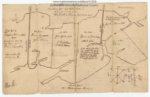
Contributed by: Maine Historical Society Date: 1771-06-17 Location: Harpswell Media: Ink on paper
Item 11743

Contributed by: Maine Historical Society Date: 1742-11-12 Location: Harpswell Media: Ink on paper
Item 22215
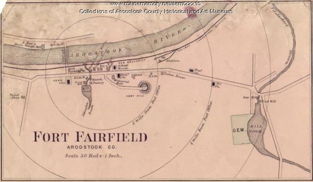
Map of Fort Fairfield, ca. 1870
Contributed by: Aroostook County Historical and Art Museum Date: circa 1870 Location: Fort Fairfield Media: Ink on paper
Item 11730

Contributed by: Maine Historical Society Date: 1761-11-12 Location: Topsham Media: Ink on paper
Item 16542

Rangley Lakes region map, 1876
Contributed by: Maine Historical Society Date: 1876 Media: Ink on paper
Item 17126
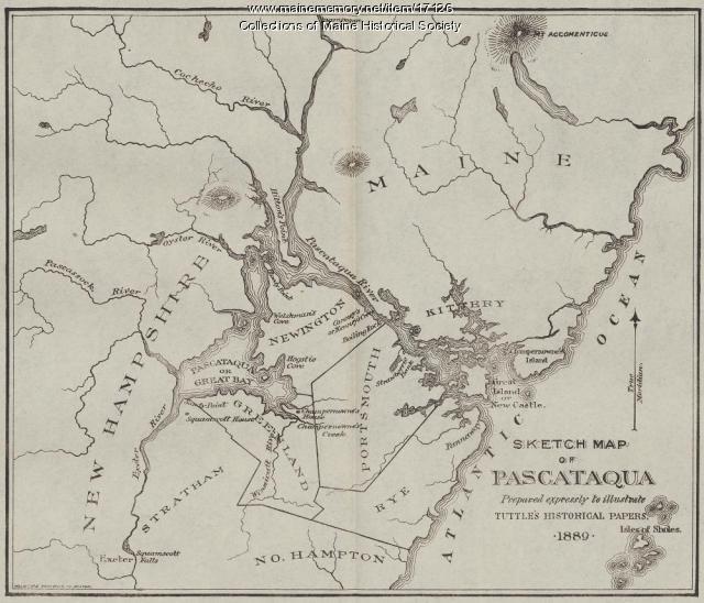
Sketch Map of Pascataqua, ca. 1690
Contributed by: Maine Historical Society Date: circa 1690 Media: Ink on paper, map
Item 105518

Contributed by: Osher Map Library and Smith Center for Cartographic Education Date: circa 1855 Location: Saco; Biddeford Media: Lithograph
Item 68865

Contributed by: Maine Historical Society Date: 1784 Location: Scarborough Media: Ink on paper
Item 11725

Contributed by: Maine Historical Society Date: 1772 Location: Brunswick Media: Ink on paper
Item 10762

Enclosure map, Stroudwater, 1756
Contributed by: Maine Historical Society Date: 1756 Location: Portland; Westbrook Media: Ink on paper
Item 18717

Map of the City of Portland, 1836
Contributed by: Maine Historical Society Date: 1836 Location: Portland Media: Ink on paper
Item 12396

Androscoggin River area map, 1771
Contributed by: Maine Historical Society Date: 1771-06-11 Location: Jay; Canton; Livermore Falls Media: Ink on paper
Item 12398

Early map of the Sheepscot River, 1816
Contributed by: Maine Historical Society Date: 1816-01-08 Location: Somerville; Whitefield; Windsor Media: Ink on paper
Item 9166

Contributed by: Maine Historical Society Date: 1795 Media: Ink on paper
