Keywords: early landowners
- Historical Items (110)
- Tax Records (2)
- Architecture & Landscape (0)
- Online Exhibits (16)
- Site Pages (55)
- My Maine Stories (1)
- Lesson Plans (0)
Historical Items
These results include photographs, documents, letters, paintings, artifacts, and many other kinds of Maine related items from collections around the state and elsewhere.
Item 5965

William Patten's land, Topsham, 1770
Contributed by: Maine Historical Society Date: 1770-05-28 Location: Topsham Media: Ink on paper
Item 5957

William Patten's land, Topsham, 1771
Contributed by: Maine Historical Society Date: 1771-04-12 Location: Bowdoinham Media: Ink on paper
Item 7582

Kennebec Proprietor meeting notes, Boston, 1751
Contributed by: Maine Historical Society Date: 1751-12-06 Location: Boston Media: Ink on paper
Item 23336

Contributed by: Maine Historical Society Date: 1793 Location: Porter; Brownfield Media: Ink on paper
Item 5890

Sara Cotta's lot, Brunswick, 1731
Contributed by: Maine Historical Society Date: 1731 Location: Brunswick Media: Ink on paper
Item 102069

Early map of Lewiston, Auburn and Minot, 1820
Contributed by: Maine Historical Society Date: 1820 Location: Lewiston; Auburn; Minot Media: Ink on paper
Item 11965

Contributed by: City of Portland Dept. of Public Works Date: 1773 Location: Portland Media: Ink on paper, map
Item 12631

Five farm lots, Bowdoinham, 1718
Contributed by: Maine Historical Society Date: 1718 Location: Bowdoinham Media: Ink on paper
Item 5343

Contributed by: Maine Historical Society Date: 1743 Location: Harpswell Media: Ink on paper
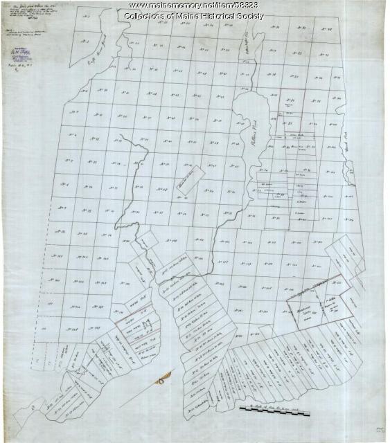
Item 58322

Copy of early Surry map, ca. 1880
Contributed by: Maine Historical Society Date: circa 1880 Location: Surry Media: Ink on paper
Item 12203

Benjamin and Nehemiah Turner's plan containing 200 acres, Palermo, 1806
Contributed by: Maine Historical Society Date: 1806-06-18 Location: Palermo Media: Ink on paper
Item 68870

Lower part of Scarborough, ca. 1740
Contributed by: Maine Historical Society Date: circa 1740 Location: Scarborough Media: Ink and wash on paper
Item 11960

Plan of land on Bramhall Hill by Peleg Wadsworth, ca. 1800
Contributed by: City of Portland Dept. of Public Works Date: circa 1800 Location: Portland Media: Ink and wash on paper, map
Item 12566

Contributed by: Maine Historical Society Date: 1778 Location: Alna Media: Ink on paper
Item 12852

Kennebec River above Fort Western, ca. 1800
Contributed by: Maine Historical Society Date: circa 1800 Media: Ink on paper
Item 109025

Manuscript map of Topsham Lots, 1763
Contributed by: Maine Historical Society Date: 1763 Location: Topsham Media: Ink on paper
Item 12943

Plan of lots on the Sheepscot River, Alna, 1798
Contributed by: Maine Historical Society Date: 1759 Location: Alna Media: Ink on paper
Item 20784

Black Point, Scarborough, ca. 1633 - 1728
Contributed by: Maine Historical Society Date: circa 1633 Location: Scarborough Media: Ink on paper, map
Item 109000

Dresden and Woolwich proposed border, ca. 1757
Contributed by: Maine Historical Society Date: circa 1757 Location: Woolwich; Dresden Media: Ink on paper
Item 68914

Samuel Calf's land, Scarborough, 1786
Contributed by: Maine Historical Society Date: 1786 Location: Scarborough Media: Ink on paper
Item 58323
Copy of Surry and Ellsworth map, ca. 1880
Contributed by: Maine Historical Society Date: circa 1880 Location: Ellsworth; Surry Media: Ink on paper
Item 12196

Map of Kennebec Purchase lots, ca. 1750
Contributed by: Maine Historical Society Date: circa 1750 Media: Ink on paper
Item 12572

Contributed by: Maine Historical Society Date: 1731 Location: Brunswick; Phippsburg Media: Ink on paper
Item 12940

Map of lots G1 and G2 for James Pitts, near Clinton, 1769
Contributed by: Maine Historical Society Date: 1769-11-07 Location: Skowhegan Media: Ink on paper
