Keywords: Political Map
- Historical Items (137)
- Tax Records (0)
- Architecture & Landscape (2)
- Online Exhibits (20)
- Site Pages (75)
- My Maine Stories (3)
- Lesson Plans (2)
Historical Items
These results include photographs, documents, letters, paintings, artifacts, and many other kinds of Maine related items from collections around the state and elsewhere.
Item 105439

Plan of the village of Augusta, 1838
Contributed by: Osher Map Library and Smith Center for Cartographic Education Date: 1838 Location: Augusta Media: Lithograph
Item 105920

Redline map of Portland and South Portland, 1935
Contributed by: Maine Historical Society Date: 1935-11-15 Location: Portland; South Portland Media: Ink on paper
Item 104603

Map of the State of Maine, 1820
Contributed by: Osher Map Library and Smith Center for Cartographic Education Date: 1820 Media: Engraving
Item 28353
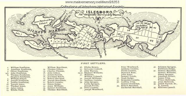
Warren Survey Map, Islesboro, ca. 1893
Contributed by: Islesboro Historical Society Date: circa 1799 Location: Islesboro Media: Ink on paper
Item 100725

Contributed by: Maine Historical Society Date: 1858 Location: Portland Media: Lithograph with hand-coloring
Item 104602

A plan of the District of Maine, 1795
Contributed by: Osher Map Library and Smith Center for Cartographic Education Date: 1795 Media: Ink on Paper
Item 105268

Contributed by: Osher Map Library and Smith Center for Cartographic Education Date: 1875 Location: Belfast Media: Lithograph
Item 11834

Map showing Monument and Glendenning Brooks, 1924
Contributed by: Maine Historical Society Date: 1924 Media: Ink on paper, map
Item 31237

Moses Banks Map, Scarborough, 1787
Contributed by: Scarborough Historical Society & Museum Date: 1787 Location: Scarborough Media: Paper and ink
Item 11836

Map of Passamoquoddy Bay, 1925
Contributed by: Maine Historical Society Date: 1925 Media: Ink on paper, map
Item 10832

Map by Francis Joseph Neptune, Cobscook River, 1798
Contributed by: Maine Historical Society Date: 1798 Media: Ink on paper
Item 7494

Map of New England and New York, ca. 1676
Contributed by: Maine Historical Society Date: circa 1676 Media: Ink on paper
Item 35633

Map of the state of Maine, 1843
Contributed by: Maine Historical Society Date: 1843 Media: Ink on paper
Item 11730

Contributed by: Maine Historical Society Date: 1761-11-12 Location: Topsham Media: Ink on paper
Item 11725

Contributed by: Maine Historical Society Date: 1772 Location: Brunswick Media: Ink on paper
Item 35632

Map of the state of Maine, 1822
Contributed by: Maine Historical Society Date: 1822 Media: Ink on paper
Item 11741

Contributed by: Maine Historical Society Date: 1742 Location: Harpswell Media: Ink on paper
Item 34148

Black Point, Scarborough, ca. 1741
Contributed by: Scarborough Historical Society & Museum Date: circa 1741 Location: Scarborough Media: Paper on cardboard
Item 11043

Waterfront and downtown Bath, 1851
Contributed by: Patten Free Library Date: 1851 Location: Bath Media: Ink on paper
Item 11732

Contributed by: Maine Historical Society Date: circa 1760 Location: Topsham Media: Ink on paper
Item 36927

Map of underground routes to Canada, 1898
Contributed by: Maine Historical Society Date: 1780–1865 Media: Ink on paper
Item 103174

Colin Dunn's map of Westport Island, 1935
Contributed by: Westport Island History Committee Date: 1935-02-01 Location: Westport Island Media: Ink on paper
Item 22213

Contributed by: Aroostook County Historical and Art Museum Date: circa 1870 Location: Mechanic Falls Media: Print
Item 51266

A.W. Longfellow map of Presumpscot River, Windham, 1840
Contributed by: Maine Historical Society Date: 1840 Location: Westbrook Media: Ink on paper
