Keywords: Landowners.
- Historical Items (423)
- Tax Records (19146)
- Architecture & Landscape (4)
- Online Exhibits (17)
- Site Pages (57)
- My Maine Stories (2)
- Lesson Plans (0)
Historical Items
These results include photographs, documents, letters, paintings, artifacts, and many other kinds of Maine related items from collections around the state and elsewhere.
Item 12631

Five farm lots, Bowdoinham, 1718
Contributed by: Maine Historical Society Date: 1718 Location: Bowdoinham Media: Ink on paper
Item 12850

Tract of land belonging to Sylvester Gardiner, Bath, 1764
Contributed by: Maine Historical Society Date: 1764-12-08 Location: Georgetown; Bath Media: Ink on paper
Item 12853

Obadiah and Phillip Call's properties, Dresden, August 7, 1758
Contributed by: Maine Historical Society Date: 1758-08-07 Location: Dresden Media: Ink on paper
Item 12937
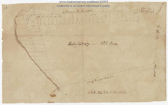
Map of lot no. 7, 135 acres on Madison Road, Skowhegan, ca. 1760
Contributed by: Maine Historical Society Date: circa 1760 Location: Skowhegan Media: Ink on paper
Item 12940

Map of lots G1 and G2 for James Pitts, near Clinton, 1769
Contributed by: Maine Historical Society Date: 1769-11-07 Location: Skowhegan Media: Ink on paper
Item 12944

Contributed by: Maine Historical Society Date: 1764 Location: Sidney Media: Ink on paper
Item 20270

Wabanaki deed to Richard Wharton, 1684
Contributed by: Maine Historical Society Date: 1684-07-07 Media: Ink on paper
Item 108837

Copy of Thomas Johnston's Plan of part of the Eastern Shore, ca. 1770
Contributed by: Maine Historical Society Date: 1753 Media: Ink on paper
Item 108839

Plat of a tract of land situated on the west side of Long Reach, Bath, 1771
Contributed by: Maine Historical Society Date: 1771 Location: Bath Media: Ink on paper
Item 108848

Map and petition, Sandy River, 1798
Contributed by: Maine Historical Society Date: 1798 Location: New Vineyard; Farmington Media: Ink on paper
Item 108862

Survey of lots for Peter Brown, Georgetown, 1761
Contributed by: Maine Historical Society Date: 1761-01-12 Location: Bath Media: Ink on paper
Item 12411

Samuel and Hugh Wilson survey, 1767
Contributed by: Maine Historical Society Date: 1767 Location: Brunswick Media: Ink on paper
Item 12572

Contributed by: Maine Historical Society Date: 1731 Location: Brunswick; Phippsburg Media: Ink on paper
Item 12628

Contributed by: Maine Historical Society Date: 1741-08-06 Location: Brunswick Media: Ink on paper
Item 12629

Contributed by: Maine Historical Society Date: 1738-01-09 Location: Phippsburg; Phippsburg Media: Ink on paper
Item 12849

Kennebec River, Lots 20-23, 1769
Contributed by: Maine Historical Society Date: 1769-10-21 Location: Augusta; Hallowell; Farmingdale; Chelsea; Randolph Media: Ink on paper
Item 12854

Contributed by: Maine Historical Society Date: 1719-05-16 Media: Ink on paper
Item 12933

Wing's Mill Pond settlers' lots, ca. 1795
Contributed by: Maine Historical Society Date: circa 1795 Location: Belgrade Media: Ink on paper
Item 12934

Land granted to William and Charles Cushing, Hallowell, 1771
Contributed by: Maine Historical Society Date: 1771-10-03 Location: Hallowell; Augusta Media: Ink on paper
Item 12938

Ten lots near Sebasticook River, ca. 1760
Contributed by: Maine Historical Society Date: circa 1760 Location: China; Vassalboro Media: Ink on paper
Item 100188

Peleg Wadsworth deed of land to Stephen Longfellow, Portland, 1827
Contributed by: Maine Historical Society Date: 1827-02-23 Location: Portland Media: Ink on paper
Item 100214

Alexander W. Longfellow site drawing, Portland, 1838
Contributed by: Maine Historical Society Date: 1838-10-28 Location: Portland Media: Ink and pencil on paper
Item 12941

Plan of the Kennebec River, Nov. 1763
Contributed by: Maine Historical Society Date: 1763 Location: Richmond Media: Ink on paper
Item 12562

Part of the Pownalborough plan, Augusta and Dresden, ca. 1760
Contributed by: Maine Historical Society Date: circa 1760 Location: Augusta; Dresden; Pittston; Randolph; Alna Media: Ink on paper
