Keywords: Route 17
Item 102745

Main Street, Coopers Mills, Whitefield, ca. 1910
Contributed by: An individual through Whitefield Historical Society Date: circa 1910 Location: Whitefield Media: Postcard
Item 80804
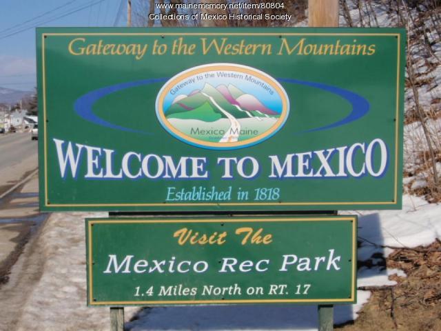
Welcome to Mexico sign, ca. 2008
Contributed by: Mexico Historical Society Date: circa 2008 Location: Mexico Media: Wood, metal

Item 116423

Pike Memorial Hall, Cornish, 1925
Contributed by: Maine Historical Society Date: 1925 Location: Cornish Client: unknown Architect: John Calvin Stevens and John Howard Stevens Architects
Exhibit

This collection of images portrays many buildings in Sanford and Springvale. The images were taken around the turn of the twentieth century.
Exhibit

Melting snow, ice, warmer temperatures, and rain sometimes bring floods to Maine's many rivers and streams. Floods are most frequent in the spring, but can occur at any season.

Site Page
Skowhegan Community History - The Skowhegan Island
"… settlements, Skowhegan Island was used as a route by Native Americans on their annual trip to the seacoast."
Site Page

Biddeford History & Heritage Project - IV. Engulfed by nationalism: Revolutionary Biddeford
"Before 1800 there were 17 sawmills around the falls, cutting an estimated 50,000 feet of boards every day."

Story

My father, Earle Ahlquist, served during World War II
by Earlene Chadbourne
Earle Ahlquist used his Maine common sense during his Marine service and to survive Iwo Jima
Story

Vietnam Memoirs
by David Chessey
MY PERSONAL EXPERIENCES AND MY OBSERVATION OF NATIONWIDE OPINIONS CONCERNING THE “VIET NAM" WAR
