LC Subject Heading: Maps, Early
- Historical Items (111)
- Tax Records (0)
- Architecture & Landscape (0)
- Online Exhibits (0)
- Site Pages (0)
- My Maine Stories (0)
- Lesson Plans (0)
Historical Items
These results include photographs, documents, letters, paintings, artifacts, and many other kinds of Maine related items from collections around the state and elsewhere.
Item 9714

Nouvelle Ecosse ou Partie orientale du Canada, 1778
Contributed by: Acadian Archives Date: 1778 Media: Ink on paper
Item 68871

Second parish of Scarborough, 1798
Contributed by: Maine Historical Society Date: 1798 Location: Scarborough Media: Ink on paper
Item 9166

Contributed by: Maine Historical Society Date: 1795 Media: Ink on paper
Item 17126
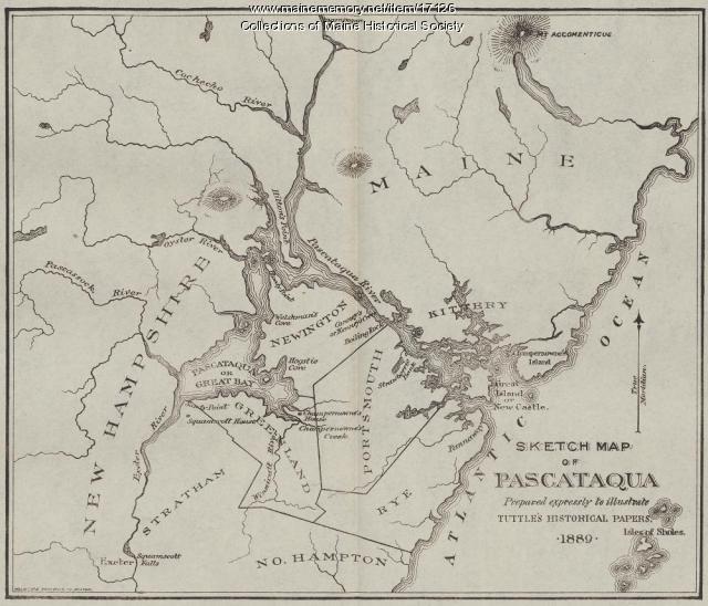
Sketch Map of Pascataqua, ca. 1690
Contributed by: Maine Historical Society Date: circa 1690 Media: Ink on paper, map
Item 68866

Libby River land, Scarborough, 1794
Contributed by: Maine Historical Society Date: 1794 Location: Scarborough; Scarborough Media: Ink on paper, map
Item 7541

Reproduction of 1620 Charter from King James I to the Council for New England, 1885
Contributed by: Maine Historical Society Date: 1620-11-03 Media: Ink on paper
Item 9359

Maine, from the United States Gazetteer, 1795
Contributed by: Maine Historical Society Date: 1795 Media: Ink on paper
Item 11945

Ramusio's Delle Nava Gationi, 1565
Contributed by: Maine Historical Society Date: 1565 Media: Ink on paper
Item 7540

Map of the New England Coast, 1610
Contributed by: Maine Historical Society Date: 1610 Media: Ink on paper
Item 9165

Contributed by: Maine Historical Society Date: 1795 Media: Ink on paper, photonegative
Item 10537

Contributed by: Maine Historical Society Date: 1717 Location: Brunswick Media: Ink on paper
Item 12849

Kennebec River, Lots 20-23, 1769
Contributed by: Maine Historical Society Date: 1769-10-21 Location: Augusta; Hallowell; Farmingdale; Chelsea; Randolph Media: Ink on paper
Item 12934

Land granted to William and Charles Cushing, Hallowell, 1771
Contributed by: Maine Historical Society Date: 1771-10-03 Location: Hallowell; Augusta Media: Ink on paper
Item 105628

Contributed by: Maine Historical Society Date: 1796 Media: Ink on paper
Item 5335

Brunswick and Topsham, ca. 1730
Contributed by: Maine Historical Society Date: circa 1730 Location: Brunswick; Topsham Media: Ink on paper
Item 12396

Androscoggin River area map, 1771
Contributed by: Maine Historical Society Date: 1771-06-11 Location: Jay; Canton; Livermore Falls Media: Ink on paper
Item 12855

Plan of Cumberland and Lincoln counties, 1773
Contributed by: Maine Historical Society Date: 1773 Media: Ink on paper
Item 12944

Contributed by: Maine Historical Society Date: 1764 Location: Sidney Media: Ink on paper
Item 109025

Manuscript map of Topsham Lots, 1763
Contributed by: Maine Historical Society Date: 1763 Location: Topsham Media: Ink on paper
Item 12562

Part of the Pownalborough plan, Augusta and Dresden, ca. 1760
Contributed by: Maine Historical Society Date: circa 1760 Location: Augusta; Dresden; Pittston; Randolph; Alna Media: Ink on paper
Item 11454

Contributed by: Maine Historical Society Date: 1763-08-11 Location: Brunswick; Topsham Media: Ink on paper
Item 12933

Wing's Mill Pond settlers' lots, ca. 1795
Contributed by: Maine Historical Society Date: circa 1795 Location: Belgrade Media: Ink on paper
Item 12935

Purchases on the Kennebec River, 1731
Contributed by: Maine Historical Society Date: 1629-01-30 Location: Richmond; Augusta Media: Ink on paper
Item 12938

Ten lots near Sebasticook River, ca. 1760
Contributed by: Maine Historical Society Date: circa 1760 Location: China; Vassalboro Media: Ink on paper
