Keywords: Early map
- Historical Items (262)
- Tax Records (0)
- Architecture & Landscape (0)
- Online Exhibits (26)
- Site Pages (131)
- My Maine Stories (7)
- Lesson Plans (0)
Historical Items
These results include photographs, documents, letters, paintings, artifacts, and many other kinds of Maine related items from collections around the state and elsewhere.
Item 10684
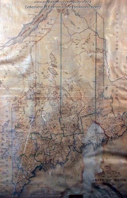
Contributed by: Salmon Brook Historical Society Date: circa 1825 Media: Digital photograph of printed map
Item 104604

New Map of English America, 1677
Contributed by: Osher Map Library and Smith Center for Cartographic Education Date: 1777 Media: Engraving
Item 102070

Early map of Lewiston, Auburn and Minot, ca. 1820
Contributed by: Maine Historical Society Date: circa 1820 Location: Auburn; Lewiston; Minot Media: Ink on paper
Item 102069

Early map of Lewiston, Auburn and Minot, 1820
Contributed by: Maine Historical Society Date: 1820 Location: Lewiston; Auburn; Minot Media: Ink on paper
Item 7493

Nova Anglia Septentrionali, ca. 1759
Contributed by: Maine Historical Society Date: circa 1720 Media: Map ink on paper
Item 135882

Contributed by: Osher Map Library and Smith Center for Cartographic Education Date: 1761 Media: Ink on paper
Item 104600

Map of the District of Maine, 1815
Contributed by: Osher Map Library and Smith Center for Cartographic Education Date: 1815 Media: Engraving
Item 104601

Contributed by: Osher Map Library and Smith Center for Cartographic Education Date: 1677 Media: Woodcut
Item 104603

Map of the State of Maine, 1820
Contributed by: Osher Map Library and Smith Center for Cartographic Education Date: 1820 Media: Engraving
Item 104602

A plan of the District of Maine, 1795
Contributed by: Osher Map Library and Smith Center for Cartographic Education Date: 1795 Media: Ink on Paper
Item 7489

Nova Anglia, Novum Belgium et Virginia, ca. 1642
Contributed by: Maine Historical Society Date: circa 1642 Media: Map, ink on paper
Item 7490

Nova Belgica et Anglia Nova, ca. 1635
Contributed by: Maine Historical Society Date: circa 1635 Media: Map, ink on paper
Item 7492

Novi Belgii: Novaeque Angliae Nec Non partis Virginiae, ca. 1655
Contributed by: Maine Historical Society Date: circa 1655 Media: Map, ink on paper
Item 102071

Map of early Greene, Lewiston and Sabattus, ca. 1790
Contributed by: Maine Historical Society Date: circa 1790 Location: Sabattus; Greene Media: Ink on vellum
Item 11730

Contributed by: Maine Historical Society Date: 1761-11-12 Location: Topsham Media: Ink on paper
Item 7491

Contributed by: Maine Historical Society Date: 1650 Media: Map, ink on paper
Item 11965

Contributed by: City of Portland Dept. of Public Works Date: 1773 Location: Portland Media: Ink on paper, map
Item 104783

Contributed by: Osher Map Library and Smith Center for Cartographic Education Date: 1794 Media: Engraving
Item 11725

Contributed by: Maine Historical Society Date: 1772 Location: Brunswick Media: Ink on paper
Item 11732

Contributed by: Maine Historical Society Date: circa 1760 Location: Topsham Media: Ink on paper
Item 18722

Modern rendering of John Small's map of Falmouth, 1753
Contributed by: Maine Historical Society Date: 1753 Location: Falmouth Media: Map, ink on paper
Item 10097

Contributed by: The General Henry Knox Museum Date: 1786 Media: Ink on paper
Item 104938

"New England the Most Remarqueable Parts Thus Named," 1637
Contributed by: Osher Map Library and Smith Center for Cartographic Education Date: circa 1614 Media: Engraving
Item 11827
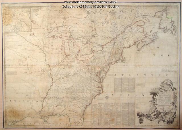
Map of the British and French North America, 1775
Contributed by: Maine Historical Society Date: 1755 Media: Ink on paper, map
