Category: Nature & Geography, Maps
- Historical Items (576)
- Tax Records (0)
- Architecture & Landscape (0)
- Online Exhibits (6)
- Site Pages (10)
- My Maine Stories (1)
- Lesson Plans (1)
Historical Items
These results include photographs, documents, letters, paintings, artifacts, and many other kinds of Maine related items from collections around the state and elsewhere.
Item 116488

A New Map of the Province of Lower Canada, 1838
Contributed by: Maine Historical Society Date: 1838 Media: Ink on paper
Item 116515

St. John River boundary survey, from Rose Island north and east, 1844
Contributed by: Maine Historical Society Date: 1844 Media: Ink on paper
Item 116516

Extract from a Map of the British and French Dominions in North America, 1755
Contributed by: Maine Historical Society Date: circa 1755 Media: Ink on paper
Item 116533

St. John River boundary survey, 1843-1844
Contributed by: Maine Historical Society Date: circa 1844 Media: Ink on paper
Item 116534

St. John River boundary survey, Five Islands, 1843
Contributed by: Maine Historical Society Date: 1843 Media: Ink on paper
Item 116545

Contributed by: Maine Historical Society Date: circa 1820 Media: Ink on paper
Item 116547

Northeastern Boundary of Minnesota, ca. 1820
Contributed by: Maine Historical Society Date: circa 1820 Media: Ink on paper
Item 116550

Lac La Croix, Iron Lake, Crooked Lake, ca. 1825
Contributed by: Maine Historical Society Date: circa 1825 Media: Ink on paper
Item 5179

Eastern Cemetery, Portland, 1889
Contributed by: Maine Historical Society Date: 1889 Location: Portland Media: Blueprint
Item 9261

Contributed by: Maine Historical Society Date: 1814 Media: Pencil and ink
Item 10834

Maine, Freeport sheet, Topographic map, 1892
Contributed by: Maine Historical Society Date: 1892 Media: Ink on paper
Item 10887

Map from Hay's Guide to Portland and Motoring in Maine, 1928
Contributed by: Maine Historical Society Date: 1928 Media: Ink on paper, map
Item 11778

Chart of the Coast of Maine, ca. 1890
Contributed by: Maine Historical Society Date: circa 1890 Media: Ink on paper, map
Item 11990

United States-British provinces boundaries, 1843
Contributed by: Maine Historical Society Date: 1843 Media: Ink on paper
Item 16997

Map of Fryeburg Village in 1878
Contributed by: Fryeburg Historical Society Date: circa 1878 Location: Fryeburg Media: Map
Item 23335

Evergreen Cemetery, Portland, 1869
Contributed by: Maine Historical Society Date: 1868 Location: Portland Media: Ink on paper
Item 23342

Contributed by: Maine Historical Society Date: circa 1850 Location: Thomaston Media: Ink on paper, map
Item 26674

Map of Cobscook Bay Area, 1881
Contributed by: Lubec Historical Society through Lubec Memorial Library Date: 1881 Media: Photo negative
Item 30213

Contributed by: Prince Memorial Library Date: 1857 Location: Cumberland Media: Wall map, ink on paper
Item 31883

Map of Cumberland County, 1880
Contributed by: North Yarmouth Historical Society Date: 1880 Media: Ink on paper
Item 58322

Copy of early Surry map, ca. 1880
Contributed by: Maine Historical Society Date: circa 1880 Location: Surry Media: Ink on paper
Item 58323
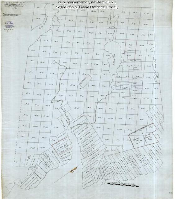
Copy of Surry and Ellsworth map, ca. 1880
Contributed by: Maine Historical Society Date: circa 1880 Location: Ellsworth; Surry Media: Ink on paper
Item 71152

Bird's eye view, Vinalhaven, 1893
Contributed by: Boston Public Library Date: 1893 Location: Vinalhaven Media: Ink on paper
Item 102071

Map of early Greene, Lewiston and Sabattus, ca. 1790
Contributed by: Maine Historical Society Date: circa 1790 Location: Sabattus; Greene Media: Ink on vellum
