Category: Nature & Geography, Maps
- Historical Items (585)
- Tax Records (0)
- Architecture & Landscape (0)
- Online Exhibits (6)
- Site Pages (10)
- My Maine Stories (1)
- Lesson Plans (1)
Historical Items
These results include photographs, documents, letters, paintings, artifacts, and many other kinds of Maine related items from collections around the state and elsewhere.
Item 110909

Map of the Northern part of the state of Maine and of the adjacent British Provinces, 1830
Contributed by: Maine Historical Society Date: 1830 Media: Ink on paper
Item 116488

A New Map of the Province of Lower Canada, 1838
Contributed by: Maine Historical Society Date: 1838 Media: Ink on paper
Item 116515

St. John River boundary survey, from Rose Island north and east, 1844
Contributed by: Maine Historical Society Date: 1844 Media: Ink on paper
Item 116516

Extract from a Map of the British and French Dominions in North America, 1755
Contributed by: Maine Historical Society Date: circa 1755 Media: Ink on paper
Item 116533

St. John River boundary survey, 1843-1844
Contributed by: Maine Historical Society Date: circa 1844 Media: Ink on paper
Item 116534

St. John River boundary survey, Five Islands, 1843
Contributed by: Maine Historical Society Date: 1843 Media: Ink on paper
Item 116545

Contributed by: Maine Historical Society Date: circa 1820 Media: Ink on paper
Item 116547

Northeastern Boundary of Minnesota, ca. 1820
Contributed by: Maine Historical Society Date: circa 1820 Media: Ink on paper
Item 116550

Lac La Croix, Iron Lake, Crooked Lake, ca. 1825
Contributed by: Maine Historical Society Date: circa 1825 Media: Ink on paper
Item 5179

Eastern Cemetery, Portland, 1889
Contributed by: Maine Historical Society Date: 1889 Location: Portland Media: Blueprint
Item 9261

Contributed by: Maine Historical Society Date: 1814 Media: Pencil and ink
Item 10834

Maine, Freeport sheet, Topographic map, 1892
Contributed by: Maine Historical Society Date: 1892 Media: Ink on paper
Item 10887

Map from Hay's Guide to Portland and Motoring in Maine, 1928
Contributed by: Maine Historical Society Date: 1928 Media: Ink on paper, map
Item 11778

Chart of the Coast of Maine, ca. 1890
Contributed by: Maine Historical Society Date: circa 1890 Media: Ink on paper, map
Item 11990

United States-British provinces boundaries, 1843
Contributed by: Maine Historical Society Date: 1843 Media: Ink on paper
Item 16997

Map of Fryeburg Village in 1878
Contributed by: Fryeburg Historical Society Date: circa 1878 Location: Fryeburg Media: Map
Item 23335

Evergreen Cemetery, Portland, 1869
Contributed by: Maine Historical Society Date: 1868 Location: Portland Media: Ink on paper
Item 23342

Contributed by: Maine Historical Society Date: circa 1850 Location: Thomaston Media: Ink on paper, map
Item 26674

Map of Cobscook Bay Area, 1881
Contributed by: Lubec Historical Society through Lubec Memorial Library Date: 1881 Media: Photo negative
Item 30213

Contributed by: Prince Memorial Library Date: 1857 Location: Cumberland Media: Wall map, ink on paper
Item 31883

Map of Cumberland County, 1880
Contributed by: North Yarmouth Historical Society Date: 1880 Media: Ink on paper
Item 58322

Copy of early Surry map, ca. 1880
Contributed by: Maine Historical Society Date: circa 1880 Location: Surry Media: Ink on paper
Item 58323
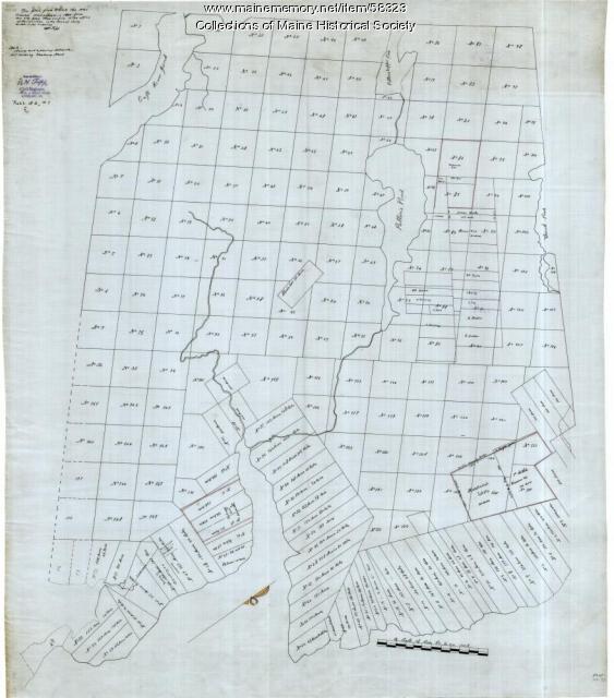
Copy of Surry and Ellsworth map, ca. 1880
Contributed by: Maine Historical Society Date: circa 1880 Location: Ellsworth; Surry Media: Ink on paper
Item 71152

Bird's eye view, Vinalhaven, 1893
Contributed by: Boston Public Library Date: 1893 Location: Vinalhaven Media: Ink on paper
