Keywords: Local Forts
- Historical Items (28)
- Tax Records (0)
- Architecture & Landscape (0)
- Online Exhibits (40)
- Site Pages (27)
- My Maine Stories (4)
- Lesson Plans (0)
Site Pages
These sites were created for each contributing partner or as part of collaborative community projects through Maine Memory. Learn about collaborative projects on MMN.
Site Page

View collections, facts, and contact information for this Contributing Partner.
Site Page

"… Johnson Hall in New York and even further west at Fort Niagara. The fundamental treaty that made fixing the international border such a long and…"
Site Page

"… Land: The Northeastern Boundary in Treaties and Local Reality, 1763-1842 While national and imperial leaders were pleased with the 1842 border…"
Site Page

"… Land: The Northeastern Boundary in Treaties and Local Reality, 1763-1842 Essay by Liam Riordan Riordan is American historian specializing in the…"
Site Page

"… Land: The Northeastern Boundary in Treaties and Local Reality, 1763-1842 Moose River, Moose Head Lake and Kennebeck Road, 1820Maine…"
Site Page

"… Land: The Northeastern Boundary in Treaties and Local Reality, 1763-1842 British survey highlands map, ca."
Site Page

View collections, facts, and contact information for this Contributing Partner.
Site Page

Thomaston: The Town that Went to Sea - Early History - 1719 to 1740
"George (the area later known as Fort Wharf), the fort was located at the southeastern side of lower Knox Street, currently the site of the Lyman…"
Site Page

Blake Library Special Collections, UMFK
View collections, facts, and contact information for this Contributing Partner.
Site Page

Presque Isle: The Star City - Maine Farmer's Exchange (MFX) Building
"Presque Isle, 2006. Graves III, Richard A. Forgotten Times: A Walk Though History. Fort Fairfield, Maine: C3creative, 2007."
Site Page

"… sided with the Penobscots in the 1730s, against local settlers, because of Dummer’s Treaty. This is like the outcome of the Passamaquoddy v."
Site Page

Thomaston: The Town that Went to Sea - Thomaston is Incorporated - 1777
"… the war, about 175 remaining settlers left the fort and went back to their farms, and the garrison at the fort was discontinued by 1762."
Site Page

Presque Isle: The Star City - Harvesting Potatoes - Page 9 of 13
"… from the northern part of Aroostook from the Fort Kent, Madawaska, and Van Buren areas would come to Presque Isle to work in various harvesting…"
Site Page

"After being forced to pay the locals for this land, some New Englanders said that “Indian deeds” were a valid form of title on their own, rather than…"
Site Page

"… of using the site as a base for converting the local population. The French quickly abandoned the island, however, after a disastrous winter that…"
Site Page
"… at the mouth of the Saco River and Union forts at Portland Harbor. There is Biddeford granite in the Lincoln monument in Springfield, Illinois and…"
Site Page

Historic Hallowell - Hallowell Schools
"… the founders constructed a meeting house at “the Fort,” a movement for the funding of the school was organized."
Site Page

Biddeford History & Heritage Project - III. An undercurrent of danger: Colonial Biddeford
"… area still ran along the river, and were close by Fort Mary (the local garrison) or the village of Winter Harbor, and settlers continued to farm…"
Site Page

John Martin: Expert Observer - Scrap & Sketch Book 2: 1864-1866
"… performance, loss of manners Part 7, pages 114-134 Soldiers, Fort Point excursion, women's fashion, behavior; crime, dance X"
Site Page

Surry by the Bay - Early Twentieth Century
"… River from Prospect to Buckport, just upriver of Fort Knox. Otherwise they had to travel all the way to Bangor and down US Route 1A to Surry."
Site Page

Thomaston: The Town that Went to Sea - Henry Knox: Lime Works
"… century lime kilns were operating near the old Fort Wharf, located at the base of Knox Street, near where the Knox mansion had stood."
Site Page

Scarborough Historical Society & Museum
View collections, facts, and contact information for this Contributing Partner.
Site Page

Scarborough: They Called It Owascoag - Historical Overview - Page 2 of 4
"While a new fort was built at the western side of Garrison Cove, the settlers lived aboard their ship."
Site Page

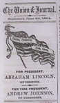
Cumberland & North Yarmouth - Brothers of the Civil War
"… On April 12, 1861, Confederate forces fired on Fort Sumter in Charleston, South Carolina’s harbor."
