Keywords: St. John River
- Historical Items (163)
- Tax Records (0)
- Architecture & Landscape (2)
- Online Exhibits (60)
- Site Pages (102)
- My Maine Stories (6)
- Lesson Plans (0)
Site Pages
These sites were created for each contributing partner or as part of collaborative community projects through Maine Memory. Learn about collaborative projects on MMN.
Site Page

Scarborough: They Called It Owascoag - Catch of the Day: Clamming and Lobstering - Page 2 of 4
"… but also for other creatures in the marshes, rivers and the ocean’s edge. The number of commercial licenses is limited and they are difficult to…"
Site Page

New Portland: Bridging the Past to the Future - New Portland: Bridging the Past to the Future
"It was tough to get between villages before vehicles and roads were constructed. After settling happened between the different rivers and streams…"
Site Page

New Portland: Bridging the Past to the Future - North New Portland Village
"… miles from it's junction with the Carrabassett River. Gilman Stream rises in Lexington and provided good water power."
Site Page

Guilford, Maine - Historic Buildings - Page 1 of 2
"… two smaller buildings closer to the Piscataquis River were later replaced. The Scales building that still exists today, a brick structure, sits…"
Site Page

Islesboro--An Island in Penobscot Bay - Early Settlements
"Reference to this name cite the Pripet River and Pripet Marshes in the Ukraine. These usually frozen marshes were probably similar to those found at…"
Site Page

Presque Isle: The Star City - Arthur R. Gould
"… a holding ground for lumber up on the Aroostook River towards Washburn. He had the idea of building a railroad from Presque Isle to Washburn to…"
Site Page

Bath's Historic Downtown - History Overview
"… stretch of the Kennebec River and the system of river-parallel ridges on which the city is situated include crustal plate movements, river erosion…"
Site Page

Guilford, Maine - BUSINESSES - Page 3 of 3
"… the cars had crashed and slid to the bank of the river. It took three hours to free Green. He was then taken to a nearby barn and died three days…"
Site Page

"John River Boundary survey, 1843-1844Maine Historical Society How the long-fixed line of 1842 was created can be examined in extraordinary detail…"
Site Page

"“A Report of a Survey of the River St. Johns and of the Coast from thence to Passamaquoddy,” enclosed in Michael Francklin to the Board of Trade, 22…"
Site Page

"St. John and Penobscot Rivers map, 1798Maine Historical Society Settling other issues, especially those in Article 5 that related to the interior…"
Site Page

"John River, and state interests mobilized, especially in the US Senate, to reject the proposal, although it had other more pro-American dimensions."
Site Page

Historic Hallowell - Captains and Their Ships
"… Josh Benner, Shelby Ward, Jacob Crockett, Shania St. Pierre, and Marisa Beedle. Josh Benners and Shelby Ward' Interview with Captain Arthur Moore…"
Site Page

"Croix River. In the Passamaquoddy language the river was known as the Skutik River. Several testimonies were given about the location of the true St."
Site Page

"Lawrence, and used Champlain’s Saint Croix River as a western boundary. Yet Alexander’s attempt to actually make good on his grant by transporting…"
Site Page

Surry by the Bay - History of Surry
"Croix rivers, was inhospitable to settlement due to disputes and battles between Great Britain and France."
Site Page

"… jurisdictions between Cape Cod and the Gulf of St. Lawrence. In addition to Plymouth, Massachusetts Bay proper, and New Hampshire, British…"
Site Page
Lincoln, Maine - Aroostook War
"John River Valley , N. Aroostook Co., Me. and Madawaska Co., NB: A History of the Communities and People. Web. 8 Apr. 2010."
Site Page

"“Imaginary Lines: Transcending the St. Croix Legacy in the Northeast Borderlands,” Native America and Indigenous Studies, 1.1 (Spring 2014), 49-64."
Site Page

Historic Hallowell - Hall-Dale 7th Grade Team 2011
"Hilaire Shania St. Pierre Quinton Stebbins Dani Sweet Thea Sweet Jeffrey Veilleux II Tyler Veilleux Jessica Wallace John Wallace Liam Walp…"
Site Page

Western Maine Foothills Region - A Man's Life in a Suitcase
"John attended and graduated from St.Theresa's Catholic School where he received many certificates of honor and was a 1943 graduate of Mexico High…"
Site Page

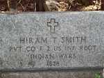
Strong, a Mussul Unsquit village - Grand Army of the Republic
"He was then captured on June 24,1864, at St. Mary’s Church in Virginia. He died on October 6, 1864, in Andersonville Prison of scorbutus."
Site Page

Presque Isle: The Star City - Transportation
"John River in Durham boats. In the 1830's the Military Road was built from Bangor to Houlton and later to points north."
Site Page

View collections, facts, and contact information for this Contributing Partner.
