Keywords: land agent
Item 7311

Ferdinand Gorges' land deed to Thomas Cammock, 1634
Contributed by: Maine Historical Society Date: 1634-05-01 Media: Ink on paper
Item 102070

Early map of Lewiston, Auburn and Minot, ca. 1820
Contributed by: Maine Historical Society Date: circa 1820 Location: Auburn; Lewiston; Minot Media: Ink on paper

Item 99287

Assessor's Record, 9-11 Portland Street, Portland, 1924
Owner in 1924: Percival Baxter Agent Use: Land
Item 63319

Assessor's Record, 184 Middle Street (rear), Portland, 1924
Owner in 1924: C.T. Whipple, Agent Use: Land only

Exhibit

Colonial Cartography: The Plymouth Company Maps
The Plymouth Company (1749-1816) managed one of the very early land grants in Maine along the Kennebec River. The maps from the Plymouth Company's collection of records constitute some of the earliest cartographic works of colonial America.
Exhibit

The boundaries of Maine are the product of international conflict, economic competition, political fights, and contested development. The boundaries are expressions of human values; people determined the shape of Maine.

Site Page

"… loyalist of New York and Nova Scotia, and British agent Ward Chipman (1754-1824), loyalist of Massachusetts and New Brunswick."
Site Page

"Effective agents needed a familiarity with the law, as the proprietors frequently resorted to filing suits of ejectment or trespass against residents."

Story
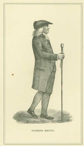
Reverend Thomas Smith of First Parish Portland
by Kristina Minister, Ph.D.
Pastor, Physician, Real Estate Speculator, and Agent for Wabanaki Genocide
Story

August 12, 1967 was the most significant day of my life
by Bob Small
How the Vietnam war affected my life

