Contributed by Maine Historical Society


Description
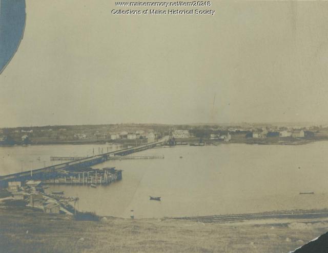
Street-level view (toward Tukey's Bridge) of the completed Baxter Boulevard on-ramp for the East Deering Bypass. The bridge connected Portland's Deering neighborhood with Munjoy Hill and the City's east end.
About This Item
- Title: Street view of the East Deering bypass, Portland, 1954
- Creator: Portland Evening Express
- Creation Date: 1954-08-06
- Subject Date: 1954-08-06
- Location: East Deering, Portland, Cumberland County, ME
- Media: Photographic Print
- Dimensions: 20.5 cm x 25.4 cm
- Local Code: Photographs--Portland--Streets--Washington
- Object Type: Image
Cross Reference Searches
Standardized Subject Headings
- Bridges--Maine--Portland
- Interstate 295 Connector Road (Portland, Me.)
- Roads--Maine--Portland
- Streets--Maine--Portland
- Washington Street (Portland, Me.)
- East Deering (Portland, Me.)
Other Keywords
For more information about this item, contact:
Maine Historical Society485 Congress Street, Portland, ME 04101
(207) 774-1822 x230
Website
This Item is protected by copyright and/or related rights. No Permission is required to use the low-resolution watermarked image for educational use, or as allowed by the applicable copyright. For all other uses, permission is required.
More to Consider
Item 20248
Tukey's Bridge, Portland, ca. 1900
Item 103529

Aerial view of Baxter Boulevard on-ramp, Portland, 1953
Item 103533

East Deering bypass construction, Portland, 1953
Please post your comment below to share with others. If you'd like to privately share a comment or correction with MMN staff, please send us a message with this link.
