Keywords: Kennebec River (N.H. and Me.)
- Historical Items (45)
- Tax Records (0)
- Architecture & Landscape (0)
- Online Exhibits (5)
- Site Pages (51)
- My Maine Stories (1)
- Lesson Plans (0)
Site Pages
These sites were created for each contributing partner or as part of collaborative community projects through Maine Memory. Learn about collaborative projects on MMN.
Site Page

"1719Maine Historical Society The Kennebec Proprietors traced their title back to a 1629 grant by the Council of New England (granting land from King…"
Site Page

"… a surveyor named Paul Chadwick in 1809 along the Kennebec River sapped popular support for continued resistance, convincing most residents to…"
Site Page
Beyond Borders - Mapping Maine and the Northeast Boundary - Kennebec Proprietors Biographies
"… business by reviving an old Pilgrim grant on the Kennebec River in Maine. This group of wealthy, well connected merchants organized as “The…"
Site Page

"The eight original Pejepscot Proprietors quickly founded Brunswick and Topsham, and spent the next few decades struggling to recruit…"
Site Page
"… in Maine, most of the presiding members of the Kennebec and Pejepscot Proprietors lived in and around Boston."
Site Page

"Both companies formed to legitimize and take advantage of titles to vast tracts of Wabanaki Homelands, but the different origins of their claims both…"
Site Page

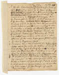
"Who were the Kennebec and Pejepscot Proprietors? Coll. 61, vol. 10, p. 179b-1 A copy of a letter issued by Samuel Goodwin to Mr."
Site Page

"The content of this collection pre‐ and post‐dates the period of the company’s operation (1749‐1816)."
Site Page

"Who were the Kennebec and Pejepscot Proprietors? Brunswick Town Meeting Minutes, 1719Maine Historical Society The Pejepscot Proprietors…"
Site Page

Beyond Borders - Mapping Maine and the Northeast Boundary - People
"Map by Francis Joseph Neptune, Cobscook River, 1798 Map by cartographer Chief Francis Joseph Neptune (Passamaquoddy), 1798Maine Historical Society…"
Site Page

"… no grants of land made in the area east of the Kennebec River would be legally recognized unless separately and specifically approved by the…"
Site Page

"… sold parcels for major settlements, and the Kennebec River watershed where the Kennebec Proprietors claimed and sold large tracts of land…"
Site Page

"… to settle a number of Irish families near the Kennebec River, the British briefly flirted with the idea of transforming the Sagadahock into its own…"
Site Page

"For example, in a 1659 Kennebec River deed, Nanudemance retained “liberty unto me and my heirs to fish, fowl, and hunt also to set otter traps…"
Site Page

"… settlement was established at the mouth of the Kennebec River. Known as the Popham or Sagadahock Colony, it barely lasted a year, from 1607-1608."
Site Page

"Settlers, including the Pejepscot and Kennebec Proprietors, sometimes relied on the Wabanaki people who remained to interpret early documents and the…"
Site Page

Beyond Borders - Mapping Maine and the Northeast Boundary - Project Home
"60), the Pejepscot Proprietors (Coll. 61), and the Barclay (Coll. 26) Collections. These collections, collectively spanning 1625 to 1893, carry what…"
Site Page

"Places like Small Point, and the councils that took place there, were not boundaries as much as confluences."
Site Page

Beyond Borders - Mapping Maine and the Northeast Boundary - Project Background
"The Plymouth Company records—also known as the Kennebec Proprietors (Coll. 60), the Proprietors of the Township of Brunswick papers—referred to as…"
Site Page

"… of some three million acres on both sides of the Kennebec River. In their squabbles with rival companies, they rejected what was by then a…"
Site Page
Beyond Borders - Mapping Maine and the Northeast Boundary - Further Reading
"Dresden, Me.: Jennie G. Everson, Eleanor L. Everson, 1977. Blaakman, Michael Albert. Speculation Nation: Land and Mania in the Revolutionary American…"
Site Page
"Meanwhile, Martha gave birth to and mothered nine children, managed the daily provisioning of her household and supervised its labors, and performed…"
Site Page
"Notably, the Kennebec Proprietors pled with him to be reimbursed for the Crown appropriating large amounts of timber for the Royal Navy, which he…"
Site Page

"… (and inaccurately) informing him that “the River Penobscot has always been deem'd and declared to be the Western boundary of Accadia or Nova…"
