LC Subject Heading: Androscoggin River (N.H. and Me.)--Maps
- Historical Items (24)
- Tax Records (0)
- Architecture & Landscape (0)
- Online Exhibits (0)
- Site Pages (0)
- My Maine Stories (0)
- Lesson Plans (0)
Historical Items
These results include photographs, documents, letters, paintings, artifacts, and many other kinds of Maine related items from collections around the state and elsewhere.
Item 108767

Plan of land in Brunswick, ca. 1800
Contributed by: Maine Historical Society Date: circa 1800 Location: Brunswick Media: Ink on paper
Item 10833

Topographic map, Bath sheet, 1894
Contributed by: Maine Historical Society Date: 1894 Media: Map, ink on paper
Item 27752

Plan of the Androscoggin River at Brunswick & Topsham, 1835
Contributed by: Maine Historical Society Date: 1835 Location: Topsham; Brunswick Media: Ink on paper
Item 71163

Livermore Falls bird's-eye view, 1889
Contributed by: Boston Public Library Date: 1889 Location: Livermore Falls Media: Ink on paper, lithograph
Item 102069

Early map of Lewiston, Auburn and Minot, 1820
Contributed by: Maine Historical Society Date: 1820 Location: Lewiston; Auburn; Minot Media: Ink on paper
Item 102071

Map of early Greene, Lewiston and Sabattus, ca. 1790
Contributed by: Maine Historical Society Date: circa 1790 Location: Sabattus; Greene Media: Ink on vellum
Item 108760

Survey of lots near Great and Little Androscoggin Rivers, ca. 1800
Contributed by: Maine Historical Society Date: circa 1800 Media: Ink on paper
Item 109022

Disputed lot E, Brunswick, 1811
Contributed by: Maine Historical Society Date: 1811-09-03 Location: Brunswick Media: Ink on paper
Item 4323
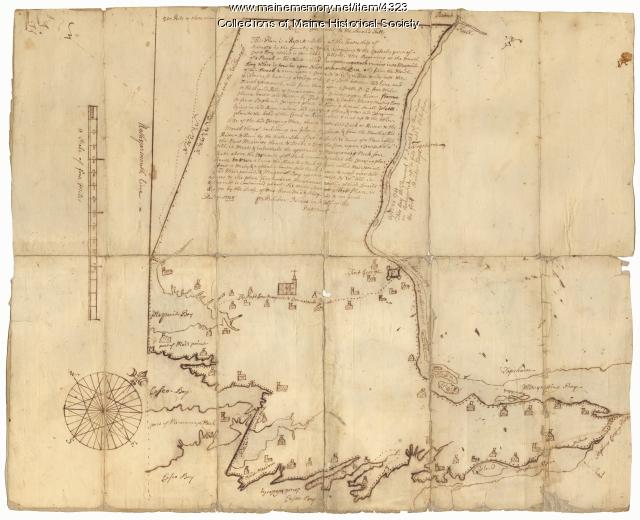
Contributed by: Maine Historical Society Date: 1738 Location: Brunswick; Harpswell; Topsham Media: Ink on paper
Item 11754

Plan for towns along the Androscoggin River, ca. 1760
Contributed by: Maine Historical Society Date: circa 1760 Location: Livermore Falls; Canton; Mexico; Jay; Leeds Media: Ink on paper
Item 11927

Thomas Wilson lot, Topsham, 1764
Contributed by: Maine Historical Society Date: 1764 Location: Topsham Media: Ink on paper
Item 11973

Contributed by: Maine Historical Society Date: 1767-10-17 Location: Topsham; Brunswick Media: Ink on paper
Item 12200

Maps of lots on the Androscoggin River, ca. 1760
Contributed by: Maine Historical Society Date: circa 1760 Location: Jay; Canton; Livermore Falls Media: Ink on paper
Item 12382

Plan of Kennebeck River, ca. 1765
Contributed by: Maine Historical Society Date: circa 1765 Media: Ink on paper
Item 12396

Androscoggin River area map, 1771
Contributed by: Maine Historical Society Date: 1771-06-11 Location: Jay; Canton; Livermore Falls Media: Ink on paper
Item 12886

James Bowdoin's property, Lisbon, ca. 1770
Contributed by: Maine Historical Society Date: circa 1770 Location: Lewiston; Lisbon Media: Ink on paper
Item 108766

Plan of lot no. 1, Lewiston, ca. 1800
Contributed by: Maine Historical Society Date: circa 1800 Location: Lewiston Media: Ink on paper
Item 4318

Androscoggin River above Lewiston, ca. 1750
Contributed by: Maine Historical Society Date: circa 1750 Location: Turner; Livermore; Wayne; Leeds Media: Ink on paper
Item 12126

Kennebec and Sagadahoc Rivers, 1755
Contributed by: Maine Historical Society Date: 1754 Media: Ink on paper
Item 12854

Contributed by: Maine Historical Society Date: 1719-05-16 Media: Ink on paper
Item 12941

Plan of the Kennebec River, Nov. 1763
Contributed by: Maine Historical Society Date: 1763 Location: Richmond Media: Ink on paper
Item 37702

Contributed by: Maine Historical Society Date: 1764-09-15 Media: Ink on paper
Item 109025

Manuscript map of Topsham Lots, 1763
Contributed by: Maine Historical Society Date: 1763 Location: Topsham Media: Ink on paper
Item 4324

Androscoggin and Kennebec Rivers, ca. 1720
Contributed by: Maine Historical Society Date: circa 1720 Media: Ink on paper
