Keywords: maps
- Historical Items (939)
- Tax Records (0)
- Architecture & Landscape (209)
- Online Exhibits (33)
- Site Pages (232)
- My Maine Stories (8)
- Lesson Plans (6)
Historical Items
These results include photographs, documents, letters, paintings, artifacts, and many other kinds of Maine related items from collections around the state and elsewhere.
Item 7490

Nova Belgica et Anglia Nova, ca. 1635
Contributed by: Maine Historical Society Date: circa 1635 Media: Map, ink on paper
Item 7491

Contributed by: Maine Historical Society Date: 1650 Media: Map, ink on paper
Item 105436

Contributed by: Osher Map Library and Smith Center for Cartographic Education Date: 1856 Location: Gardiner Media: Lithograph
Item 105434

Map of the town of Thomaston, 1855
Contributed by: Osher Map Library and Smith Center for Cartographic Education Date: 1855 Location: Thomaston Media: Lithograph
Item 11656

Maps of the Tuladie and Green Rivers, 1820
Contributed by: Maine Historical Society Date: 1820 Media: Ink on paper
Item 100727

Contributed by: Maine Historical Society Date: 1826 Location: Portland Media: Watercolor and pen and ink, mounted on fabric
Item 105520

Contributed by: Osher Map Library and Smith Center for Cartographic Education Date: circa 1907 Location: Bar Harbor Media: Lithograph
Item 105440

Map of Portland with illustrations of buildings, 1836
Contributed by: Osher Map Library and Smith Center for Cartographic Education Date: 1836 Location: Portland Media: Engraving
Item 4177

Contributed by: Maine Historical Society Date: circa 1801 Media: Paper
Item 105266

Contributed by: Osher Map Library and Smith Center for Cartographic Education Date: 1859 Media: Lithograph
Item 104938

"New England the Most Remarqueable Parts Thus Named," 1637
Contributed by: Osher Map Library and Smith Center for Cartographic Education Date: circa 1614 Media: Engraving
Item 81148

Northeast Harbor Village Map, ca. 1955
Contributed by: Northeast Harbor Library Date: circa 1955 Location: Northeast Harbor Media: Paper map
Item 71158

Birds-eye view of Stonington, 1893
Contributed by: Boston Public Library Date: 1893 Location: Stonington Media: Ink on paper
Item 62538

General Plan for Western Promenade, Portland, 1905
Contributed by: Maine Historical Society Date: 1905 Location: Portland Media: Ink on paper
Item 11833

Index Map of International Boundary, 1930
Contributed by: Maine Historical Society Date: 1930 Media: Ink on paper, map
Item 11834

Map showing Monument and Glendenning Brooks, 1924
Contributed by: Maine Historical Society Date: 1924 Media: Ink on paper, map
Item 4319

Contributed by: Maine Historical Society Date: circa 1795 Location: Freeport; New Gloucester; Brunswick Media: Ink on paper
Item 78950

Salem Towne Map, Mount Desert Island, ca. 1808
Contributed by: Mount Desert Island Historical Society Date: circa 1808 Location: Mount Desert Island Media: Map
Item 23342

Contributed by: Maine Historical Society Date: circa 1850 Location: Thomaston Media: Ink on paper, map
Item 12200

Maps of lots on the Androscoggin River, ca. 1760
Contributed by: Maine Historical Society Date: circa 1760 Location: Jay; Canton; Livermore Falls Media: Ink on paper
Item 4318

Androscoggin River above Lewiston, ca. 1750
Contributed by: Maine Historical Society Date: circa 1750 Location: Turner; Livermore; Wayne; Leeds Media: Ink on paper
Item 10684
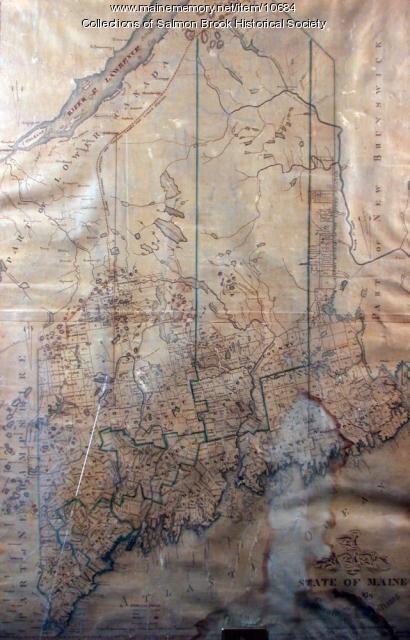
Contributed by: Salmon Brook Historical Society Date: circa 1825 Media: Digital photograph of printed map
Item 103174

Colin Dunn's map of Westport Island, 1935
Contributed by: Westport Island History Committee Date: 1935-02-01 Location: Westport Island Media: Ink on paper
Item 105270

Manuscript map of Windham, 1872
Contributed by: Osher Map Library and Smith Center for Cartographic Education Date: circa 1740 Location: Windham Media: Ink on Paper
