Keywords: map
- Historical Items (939)
- Tax Records (0)
- Architecture & Landscape (209)
- Online Exhibits (33)
- Site Pages (232)
- My Maine Stories (8)
- Lesson Plans (6)
Site Pages
These sites were created for each contributing partner or as part of collaborative community projects through Maine Memory. Learn about collaborative projects on MMN.
Site Page

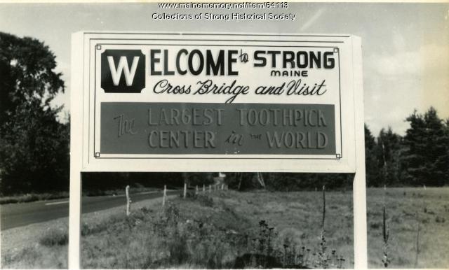
Strong, a Mussul Unsquit village - About Us - Page 2 of 3
"Carl Stinchfield's “The Bridge that Changed the Map” recounts how a $5,000 suspension bridge drove a wedge between residents in 1856 and resulted in…"
Site Page

Winter Harbor Historical Society
View collections, facts, and contact information for this Contributing Partner.
Site Page

Thomaston: The Town that Went to Sea - Thomaston Narrative
"Map of the New England Coast, 1610Maine Historical Society In 1605, after making landfall at Monhegan, Captain Waymouth re-anchored his ship…"
Site Page

Thomaston: The Town that Went to Sea - Early Wharves and Yards - 1795 to 1825
"Map of Waterfront, Thomaston, Maine 1855Thomaston Historical Society In 1823 Captain Richard Robinson acquired rights to the wharves and stores on…"
Site Page
"… Sieur de Monts and Samuel de Champlain noted and mapped the area from 1602-1606. John Smith passed through in 1614."
Site Page
"It wasn’t until 1812 that Robert Low Jr. got this warrant for Guilford to be on maps. Eight years later Guilford was better than ever and the year…"
Site Page

Strong, a Mussul Unsquit village - About Us - Page 1 of 3
"… assisted teacher Crystal Knapp Polk with class mapping activities in the Strong Elementary School and wrote an exhibit on Cornelia "Fly Rod"…"
Site Page

Historic Hallowell - Disasters - Natural and Man-made
"… images, prepared poems, timelines, cartoons, maps, podcasts, and other creative supports. Hallowell downtown on the screen in background X The…"
Site Page

Strong, a Mussul Unsquit village - About Us - Page 3 of 3
"… the society’s start of the yearlong Maine Memory project to research and map local homes, businesses and townspeople’s lives after the Civil War."
Site Page

View collections, facts, and contact information for this Contributing Partner.
Site Page

Boothbay Region Historical Society
View collections, facts, and contact information for this Contributing Partner.
Site Page

John Martin: Expert Observer - Intro: pages 74-138
"… Mary Ann Harding Attending school Classmates Map of Hampden Upper & Lower Corners Increase S. Sanger Ann Fales Sanger Ruth Mayo Hauling wood…"
Site Page

Bath's Historic Downtown - The Customs House
"1901Patten Free Library According to the 1851 map of Bath, three separate buildings occupied the property where the Customs House was later built."
Site Page

Home: The Wadsworth-Longfellow House and Portland - Researching Your Home
"… records that have been digitized Sanborn Fire Map, Portland, 1877 X Other towns have similar records."
Site Page

Mount Desert Island: Shaped by Nature - Cottagers
"… and Indian encampments, 1886 Bird's-eye view maps like this 1886 panorama of Bar Harbor were popular all across the country in the second half of…"
Site Page

Historic Hallowell - Hallowell Ice Storm of 1998
"… include a time line, comic strips, wanted ads, a map, interviews, newspaper articles, essays on days one through eight of the ice storm, about what…"
Site Page

Skowhegan Community History - About the Project
"… created a historic walking tour that includes a map and multimedia presentations on iPods that are available at the local Skowhegan Library."
Site Page

Thomaston: The Town that Went to Sea - Early Shipbuilders - 1780s
"… Early Shipbuilders - 1780s Map of the Georges River, Thomaston, Maine 2009Thomaston Historical Society By the time Thomaston was…"
Site Page

Thomaston: The Town that Went to Sea - Prison is Established - 1823
"Location of Maine State Prison from Early Map, Thomaston, Maine 1855Thomaston Historical Society In May of 1823, the Thomaston site was accepted as…"
Site Page

Androscoggin Historical Society
View collections, facts, and contact information for this Contributing Partner.
Site Page

View collections, facts, and contact information for this Contributing Partner.
Site Page

View collections, facts, and contact information for this Contributing Partner.
Site Page

View collections, facts, and contact information for this Contributing Partner.
Site Page
Strong, a Mussul Unsquit village - Student Research
"The 8th graders also worked on a digital map. The project topics chosen were: Our Conclusions As we looked at the lists of the hundreds of men who…"
