Keywords: Political Map
- Historical Items (137)
- Tax Records (0)
- Architecture & Landscape (2)
- Online Exhibits (17)
- Site Pages (78)
- My Maine Stories (3)
- Lesson Plans (2)
Historical Items
These results include photographs, documents, letters, paintings, artifacts, and many other kinds of Maine related items from collections around the state and elsewhere.
Item 11835

St. Croix Island and Passaquomoddy Bay, 1925
Contributed by: Maine Historical Society Date: 1925 Media: Ink on paper, map
Item 22212

Contributed by: Aroostook County Historical and Art Museum Date: circa 1870 Location: Houlton Media: Ink on paper
Item 110909

Map of the Northern part of the state of Maine and of the adjacent British Provinces, 1830
Contributed by: Maine Historical Society Date: 1830 Media: Ink on paper
Item 110917

Bowen & Co. United States and British possessions map, British Columbia, 1846
Contributed by: Maine Historical Society Date: circa 1846 Location: Orcas Island; Vancouver Island Media: Ink on paper
Item 6843

A map of the boundary line explored in 1817
Contributed by: Maine Historical Society Date: 1817 Media: Ink on paper
Item 68863

Copy of a plan of Black Point, Scarborough, 1741
Contributed by: Maine Historical Society Date: 1741 Location: Scarborough Media: Ink on paper, map
Item 105441

Machegonne : Portland, also called Falmouth, 1932
Contributed by: Osher Map Library and Smith Center for Cartographic Education Date: 1632–1932 Location: Portland; Falmouth Media: Lithograph
Item 11823

Champlain map copy, St. Croix or Bone Island, ca. 1799
Contributed by: Maine Historical Society Date: circa 1613 Media: Ink on paper
Item 4316

Plan of J. Robinson lot, Topsham, 1761
Contributed by: Maine Historical Society Date: 1761 Location: Topsham Media: Ink on paper
Item 33846

Biddeford and Saco downtowns, ca. 1887
Contributed by: McArthur Public Library Date: circa 1887 Location: Biddeford; Saco Media: Ink on paper
Item 11715
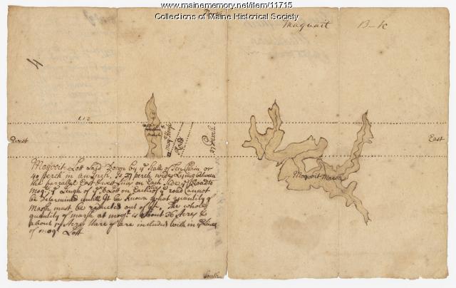
Plan of Maquoit Meadows, ca. 1720
Contributed by: Maine Historical Society Date: circa 1720 Location: Brunswick Media: Ink on paper
Item 11731

William Patten's lot, Topsham, 1761
Contributed by: Maine Historical Society Date: 1761-11-24 Location: Topsham Media: Ink on paper
Item 108767

Plan of land in Brunswick, ca. 1800
Contributed by: Maine Historical Society Date: circa 1800 Location: Brunswick Media: Ink on paper
Item 5960

Fort land for William Ross, Brunswick, ca. 1763
Contributed by: Maine Historical Society Date: circa 1763 Location: Brunswick Media: Ink on paper
Item 11922

Contributed by: Maine Historical Society Date: 1752-08-26 Location: Brunswick Media: Ink on paper
Item 11926
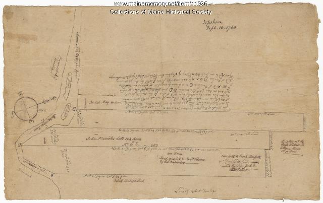
Morrill and Danforth lots, Topsham, 1760
Contributed by: Maine Historical Society Date: 1760-09-10 Location: Topsham Media: Ink on paper
Item 11979

Norridgewock Fort and Kennebec River, 1719
Contributed by: Maine Historical Society Date: 1719 Location: Norridgewock Media: Ink on paper
Item 11737
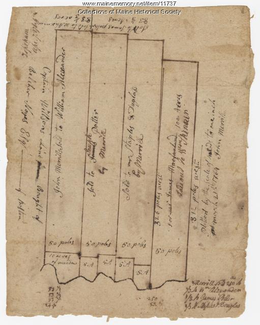
Contributed by: Maine Historical Society Date: 1764-04-07 Location: Topsham Media: Ink on paper
Item 11929
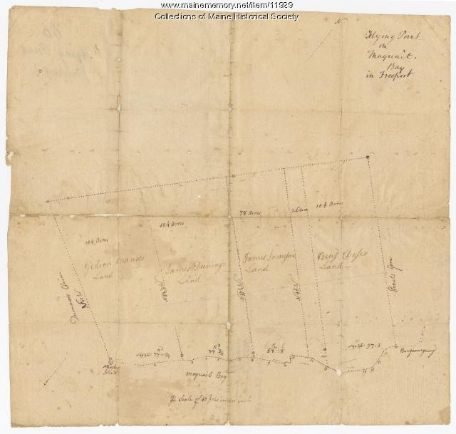
Flying Point at Maquoit Bay, Freeport, ca. 1770
Contributed by: Maine Historical Society Date: circa 1770 Location: Freeport; Brunswick Media: Ink on paper
Item 11720

Contributed by: Maine Historical Society Date: 1740-09-29 Location: Brunswick Media: Ink on paper
Item 6846

Plan of Saint Croix River, Calais, 1807
Contributed by: Maine Historical Society Date: 1807 Location: Calais Media: Ink on paper
Item 108764

Plan of suit, Little v. Field, 1823
Contributed by: Maine Historical Society Date: 1823 Media: Ink on paper
Item 11751

North Yarmouth road, Yarmouth, ca. 1760
Contributed by: Maine Historical Society Date: circa 1760 Location: Yarmouth Media: Ink on paper
Item 11758

Samuel and Hugh Wilson's lot in Topsham, 1758
Contributed by: Maine Historical Society Date: 1758 Location: Topsham; Brunswick Media: Ink on paper
