Keywords: Maps, Manuscript.
- Historical Items (357)
- Tax Records (0)
- Architecture & Landscape (0)
- Online Exhibits (9)
- Site Pages (58)
- My Maine Stories (0)
- Lesson Plans (0)
Historical Items
These results include photographs, documents, letters, paintings, artifacts, and many other kinds of Maine related items from collections around the state and elsewhere.
Item 105270

Manuscript map of Windham, 1872
Contributed by: Osher Map Library and Smith Center for Cartographic Education Date: circa 1740 Location: Windham Media: Ink on Paper
Item 104782

Contributed by: Osher Map Library and Smith Center for Cartographic Education Date: 1793 Media: Engraving
Item 135882

Contributed by: Osher Map Library and Smith Center for Cartographic Education Date: 1761 Media: Ink on paper
Item 10832

Map by Francis Joseph Neptune, Cobscook River, 1798
Contributed by: Maine Historical Society Date: 1798 Media: Ink on paper
Item 100727

Contributed by: Maine Historical Society Date: 1826 Location: Portland Media: Watercolor and pen and ink, mounted on fabric
Item 7489

Nova Anglia, Novum Belgium et Virginia, ca. 1642
Contributed by: Maine Historical Society Date: circa 1642 Media: Map, ink on paper
Item 7492

Novi Belgii: Novaeque Angliae Nec Non partis Virginiae, ca. 1655
Contributed by: Maine Historical Society Date: circa 1655 Media: Map, ink on paper
Item 109022

Disputed lot E, Brunswick, 1811
Contributed by: Maine Historical Society Date: 1811-09-03 Location: Brunswick Media: Ink on paper
Item 11963
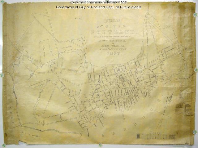
Plan of the City of Portland, 1837
Contributed by: City of Portland Dept. of Public Works Date: 1837 Location: Portland Media: Ink on paper, map
Item 7493

Nova Anglia Septentrionali, ca. 1759
Contributed by: Maine Historical Society Date: circa 1720 Media: Map ink on paper
Item 111027

Manuscript map of the Lake of the Woods, ca. 1820
Contributed by: Maine Historical Society Date: circa 1820 Media: Ink on paper
Item 104602

A plan of the District of Maine, 1795
Contributed by: Osher Map Library and Smith Center for Cartographic Education Date: 1795 Media: Ink on Paper
Item 7494

Map of New England and New York, ca. 1676
Contributed by: Maine Historical Society Date: circa 1676 Media: Ink on paper
Item 7490

Nova Belgica et Anglia Nova, ca. 1635
Contributed by: Maine Historical Society Date: circa 1635 Media: Map, ink on paper
Item 7491

Contributed by: Maine Historical Society Date: 1650 Media: Map, ink on paper
Item 9261

Contributed by: Maine Historical Society Date: 1814 Media: Pencil and ink
Item 11656

Maps of the Tuladie and Green Rivers, 1820
Contributed by: Maine Historical Society Date: 1820 Media: Ink on paper
Item 4318

Androscoggin River above Lewiston, ca. 1750
Contributed by: Maine Historical Society Date: circa 1750 Location: Turner; Livermore; Wayne; Leeds Media: Ink on paper
Item 109025

Manuscript map of Topsham Lots, 1763
Contributed by: Maine Historical Society Date: 1763 Location: Topsham Media: Ink on paper
Item 116503

Manuscript map of Lake St. Clair, 1820
Contributed by: Maine Historical Society Date: 1820 Media: Ink on paper
Item 4325

"Brunswick in the late Province of Mayne in New England," 1719
Contributed by: Maine Historical Society Date: 1718-01-28 Location: Brunswick Media: Ink on paper
Item 13074

Manuscript map of Kennebec River area, 1771
Contributed by: Maine Historical Society Date: 1771 Media: Ink on paper
Item 116495

Manuscript map of Loon's Narrows & Lac Du Bois, ca. 1822
Contributed by: Maine Historical Society Date: circa 1822 Media: Ink on paper
Item 12200

Maps of lots on the Androscoggin River, ca. 1760
Contributed by: Maine Historical Society Date: circa 1760 Location: Jay; Canton; Livermore Falls Media: Ink on paper
