Keywords: Indian deeds
- Historical Items (25)
- Tax Records (0)
- Architecture & Landscape (0)
- Online Exhibits (10)
- Site Pages (22)
- My Maine Stories (0)
- Lesson Plans (1)
Site Pages
These sites were created for each contributing partner or as part of collaborative community projects through Maine Memory. Learn about collaborative projects on MMN.
Site Page

"Without acknowledged Indian deeds of their own, the Kennebec Company came to the opposite conclusion."
Site Page

"An example of Proprietors' use of "Ancient Indian Deeds"Maine Historical Society These Proprietors collections exist because of competing colonial…"
Site Page

"For Maine proprietors, “Indian deeds” signed with Native peoples in the seventeenth century became an important element of the argument."
Site Page

"… was made not through royal seals, Indian deeds, or any deeds at all, but instead through possession—applying one’s labor to improve the land."
Site Page
"40, item 31. 3. James Berry and Rachel Berry Deed to Proprietors (1716), Proprietors of the Township of Brunswick: Pejepscot Proprietors Papers…"
Site Page

"… to the same tract, seventeenth-century Indian deeds often described vague boundaries. So, too, did the other potential sources of legal title: the…"
Site Page

"“‘A Scratch with a Bear's Paw’: Anglo-Indian Land Deeds in Early Maine,” Ethnohistory 36:3 (Summer, 1989), pp. 235-256) 3. Richardson, H."
Site Page
"… just becoming structured enough so that Indian deeds and title were only recognized as making it possible for European settlers—and European…"
Site Page

"… claims over Wabanaki lands, sometimes through deeds (or purported deeds) signed with Wabanaki leaders, and sometimes by vague agreements and grants…"
Site Page

Beyond Borders - Mapping Maine and the Northeast Boundary - Pejepscot Proprietors Papers, 1627‐1866
"It includes land deeds, depositions, maps, correspondence, broadsides, proprietor’s meetings records, accounts, land agents, and other documents…"
Site Page

"… that colonizers often benefit from such as deeds and treaties, the foundations for federal law and authority."
Site Page
"Deeds, maps, correspondence, diaries, depositions, account books, church records, lists of settlers, minutes of proprietors’ meetings and boundary…"
Site Page
Beyond Borders - Mapping Maine and the Northeast Boundary - Further Reading
"Co, 1975. Saxine, Ian. Properties of Empire: Indians, Colonists, and Land Speculators on the New England Frontier."
Site Page

"He is the author of "Properties of Empire: Indians, Colonists, and Land Speculators on the New England Frontier" (2019). Coll. 60, vol."
Site Page

"… or Iroquois, tribes) negotiated with Indian Superintendent William Johnson at Johnson Hall in New York and even further west at Fort Niagara. The…"
Site Page

"… 1794, an essential legal precedent for the Maine Indian Land Claims Settlement Act of 1980. St."
Site Page
"Properties of Empire: Indians, Colonists, and Land Speculators on the New England Frontier (New York: New York University Press, 2019) Taylor, Alan."
Site Page
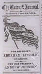
Biddeford History & Heritage Project - The Civil War & Biddeford
"Thus far we boast of deeds, not words, and while other localities may have more loudly proclaimed their devotion to our country's cause, none have in…"
Site Page

Scarborough: They Called It Owascoag - Scarborough Marsh: "Land of Much Grass" - Page 2 of 4
"… lot (or lots) for grazing their animals, later deeding these lots to their heirs. A 1784 survey of the marsh by Moses Banks noted owners of marsh…"
Site Page

Scarborough: They Called It Owascoag - Historical Overview - Page 1 of 4
"Alger Deed X A second settlement was established across the river at Blue Point in 1636. A year before Cammock's patent had been granted, the…"
Site Page

Surry by the Bay - History of Surry
"Incorporation After the Revolutionary War, deeds and titles were still not clear, so the Commonwealth of Massachusetts had to straighten things out."
Site Page

Islesboro--An Island in Penobscot Bay - Historical Overview
"… Plantation, as Islesboro was then called, took deeds from General Knox, others did not, especially those living above the Narrows."
