Category: Nature & Geography, Maps by town, Brunswick
- Historical Items (32)
- Tax Records (0)
- Architecture & Landscape (0)
- Online Exhibits (0)
- Site Pages (0)
- My Maine Stories (0)
- Lesson Plans (0)
Historical Items
These results include photographs, documents, letters, paintings, artifacts, and many other kinds of Maine related items from collections around the state and elsewhere.
Item 4323
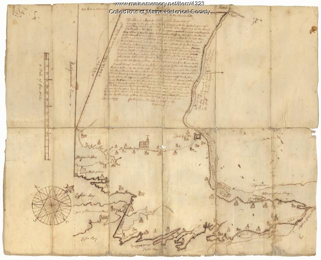
Contributed by: Maine Historical Society Date: 1738 Location: Brunswick; Harpswell; Topsham Media: Ink on paper
Item 4325

"Brunswick in the late Province of Mayne in New England," 1719
Contributed by: Maine Historical Society Date: 1718-01-28 Location: Brunswick Media: Ink on paper
Item 10537

Contributed by: Maine Historical Society Date: 1717 Location: Brunswick Media: Ink on paper
Item 11714
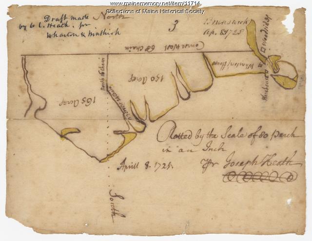
Contributed by: Maine Historical Society Date: 1725-04-08 Location: Brunswick Media: Ink on paper
Item 11717

Contributed by: Maine Historical Society Date: circa 1718 Location: Brunswick; Harpswell; Bath; Topsham Media: Ink on paper
Item 11718

Contributed by: Maine Historical Society Date: circa 1740 Location: Brunswick Media: Ink on paper
Item 11721

Plan of Land at Brunswick Narrows, 1741
Contributed by: Maine Historical Society Date: 1741 Location: Brunswick Media: Ink on paper
Item 11722

Map of Brunswick, lots on Merrymeeting Bay, ca. 1750
Contributed by: Maine Historical Society Date: circa 1750 Location: Brunswick Media: Ink on paper
Item 11724

Map of Brunswick near the Narrows, 1737
Contributed by: Maine Historical Society Date: 1737 Location: Brunswick; Topsham Media: Ink on paper
Item 11726

Contributed by: Maine Historical Society Date: 1795-05-29 Location: Brunswick; Durham; Freeport; Bath Media: Ink on paper
Item 11728

Plan of a road in Brunswick, 1764
Contributed by: Maine Historical Society Date: 1764 Location: Brunswick; Bath Media: Ink on paper
Item 11923

Survey of Robert and John Donlop lots, Brunswick, 1757
Contributed by: Maine Historical Society Date: 1757 Location: Brunswick Media: Ink on paper
Item 11924

Lots on Maquoit Road, Brunswick, 1761
Contributed by: Maine Historical Society Date: 1761 Location: Brunswick Media: Ink on paper
Item 11943

Contributed by: Maine Historical Society Date: 1749-12-04 Location: Brunswick Media: Ink on paper
Item 12411

Samuel and Hugh Wilson survey, 1767
Contributed by: Maine Historical Society Date: 1767 Location: Brunswick Media: Ink on paper
Item 12627

Merryconeag and Maquoit marshes, ca. 1730
Contributed by: Maine Historical Society Date: circa 1730 Location: Brunswick Media: Ink on paper
Item 12628

Contributed by: Maine Historical Society Date: 1741-08-06 Location: Brunswick Media: Ink on paper
Item 5335

Brunswick and Topsham, ca. 1730
Contributed by: Maine Historical Society Date: circa 1730 Location: Brunswick; Topsham Media: Ink on paper
Item 11454

Contributed by: Maine Historical Society Date: 1763-08-11 Location: Brunswick; Topsham Media: Ink on paper
Item 11715
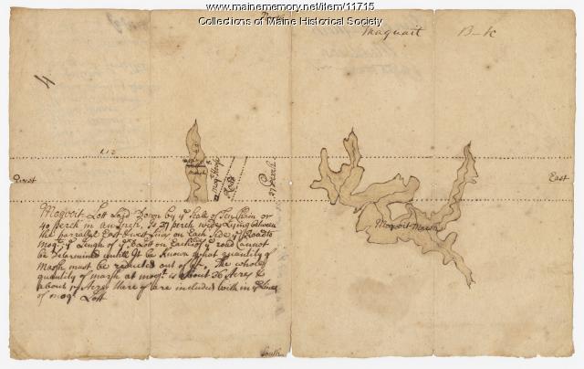
Plan of Maquoit Meadows, ca. 1720
Contributed by: Maine Historical Society Date: circa 1720 Location: Brunswick Media: Ink on paper
Item 11922

Contributed by: Maine Historical Society Date: 1752-08-26 Location: Brunswick Media: Ink on paper
Item 27752

Plan of the Androscoggin River at Brunswick & Topsham, 1835
Contributed by: Maine Historical Society Date: 1835 Location: Topsham; Brunswick Media: Ink on paper
Item 5320

Peletiah Haly's lot, Haly's Island, ca. 1750
Contributed by: Maine Historical Society Date: circa 1750 Location: Topsham; Brunswick Media: Ink on paper
Item 5960

Fort land for William Ross, Brunswick, ca. 1763
Contributed by: Maine Historical Society Date: circa 1763 Location: Brunswick Media: Ink on paper
