Category: Nature & Geography, Maps, Northeast boundary
- Historical Items (66)
- Tax Records (0)
- Architecture & Landscape (0)
- Online Exhibits (1)
- Site Pages (0)
- My Maine Stories (0)
- Lesson Plans (0)
Historical Items
These results include photographs, documents, letters, paintings, artifacts, and many other kinds of Maine related items from collections around the state and elsewhere.
Item 11990

United States-British provinces boundaries, 1843
Contributed by: Maine Historical Society Date: 1843 Media: Ink on paper
Item 116542

A Map of Campobello and other islands in the Province of New Brunswick, 1830
Contributed by: Maine Historical Society Date: 1830 Location: Campobello Island Media: Ink on paper
Item 11786

Contested Northeast boundary map, 1843
Contributed by: Maine Historical Society Date: 1843 Media: Ink on paper
Item 19364

Deane journal of Northeast Boundary Commission, 1838
Contributed by: Maine Historical Society Date: 1838 Media: Ink on paper, leather binding
Item 22489

Northern Maine boundary map, 1843
Contributed by: Maine Historical Society Date: 1843 Media: Ink on paper, map
Item 100203

Alexander Wadsworth Longfellow, Portland, ca. 1855
Contributed by: NPS, Longfellow House-Washington's Headquarters National Historic Site Date: circa 1855 Location: Portland Media: Daguerreotype
Item 110888

Map of the Northern part of the state of Maine and of the adjacent British Provinces, 1830
Contributed by: Maine Historical Society Date: circa 1830 Media: Ink on paper
Item 110909

Map of the Northern part of the state of Maine and of the adjacent British Provinces, 1830
Contributed by: Maine Historical Society Date: 1830 Media: Ink on paper
Item 116487

Canaan Corner, Northeast Boundary, ca. 1820
Contributed by: Maine Historical Society Date: circa 1820 Location: Canaan Media: Ink on paper
Item 116488

A New Map of the Province of Lower Canada, 1838
Contributed by: Maine Historical Society Date: 1838 Media: Ink on paper
Item 116515

St. John River boundary survey, from Rose Island north and east, 1844
Contributed by: Maine Historical Society Date: 1844 Media: Ink on paper
Item 116516

Extract from a Map of the British and French Dominions in North America, 1755
Contributed by: Maine Historical Society Date: circa 1755 Media: Ink on paper
Item 116533

St. John River boundary survey, 1843-1844
Contributed by: Maine Historical Society Date: circa 1844 Media: Ink on paper
Item 116534

St. John River boundary survey, Five Islands, 1843
Contributed by: Maine Historical Society Date: 1843 Media: Ink on paper
Item 116545

Contributed by: Maine Historical Society Date: circa 1820 Media: Ink on paper
Item 116547

Northeastern Boundary of Minnesota, ca. 1820
Contributed by: Maine Historical Society Date: circa 1820 Media: Ink on paper
Item 116550

Lac La Croix, Iron Lake, Crooked Lake, ca. 1825
Contributed by: Maine Historical Society Date: circa 1825 Media: Ink on paper
Item 8564

North shore, Lake Huron, ca. 1819
Contributed by: Maine Historical Society Date: circa 1819 Media: Ink on paper
Item 9599

Mucalesa Mountain from Mucalesa Pond, Talcott Survey, 1841
Contributed by: Maine Historical Society Date: 1841 Media: Phototransparency
Item 11827
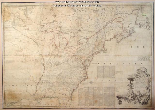
Map of the British and French North America, 1775
Contributed by: Maine Historical Society Date: 1755 Media: Ink on paper, map
Item 11830

Map of the country explored, Maine and New Brunswick, ca. 1818
Contributed by: Maine Historical Society Date: 1817 Media: Ink on paper
Item 11833

Index Map of International Boundary, 1930
Contributed by: Maine Historical Society Date: 1930 Media: Ink on paper, map
Item 12178

Moses Greenleaf vertical sections, 1829
Contributed by: Maine Historical Society Date: 1829 Media: Ink on paper
Item 17401

Falls of the Du Loup, ca. 1841
Contributed by: Maine Historical Society Date: circa 1841 Media: Transparency
