Contributed by Maine Historical Society

- Item 58323
- print page
- download web image
Purchase a reproduction of this item on VintageMaineImages.com.
Description
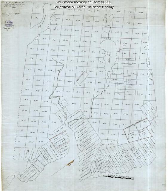
A copy from an early map of Surry and Ellsworth shows lot numbers and landowners' names. Both Surry and Ellsworth were incorporated ca. 1803. This copy was made in 1880, but shows the towns as they were in the early days of incorporation.
In 1789 Leonard Jarvis was commissioned to mete out land settled after 1784 in Township No. 6 (Surry and Ellsworth) and to sell the remainder. Jarvis and his family bought up most of the land here, becoming one of the largest landowners in Maine, after the Bingham estate.
About This Item
- Title: Copy of Surry and Ellsworth map, ca. 1880
- Creator: Oscar H. Tripp
- Creation Date: circa 1880
- Subject Date: circa 1880
-
Locations:
- Ellsworth, Hancock County, ME
- Surry, Hancock County, ME
- Media: Ink on paper
- Local Code: Map FOS 37
- Object Type: Text and Image
Cross Reference Searches
Standardized Subject Headings
- Real property--Maine--Surry
- Landowners--Maine--Ellsworth
- Manuscript maps
- Real property--Maine--Ellsworth
- Landowners--Maine--Surry
People
For more information about this item, contact:
Maine Historical Society485 Congress Street, Portland, ME 04101
(207) 774-1822 x230
Website
Use of this Item is not restricted by copyright and/or related rights, but the holding organization is contractually obligated to limit use. For more information, please contact the contributing organization. However, watermarked Maine Memory Network images may be used for educational purposes.
Please post your comment below to share with others. If you'd like to privately share a comment or correction with MMN staff, please send us a message with this link.
