LC Subject Heading: Northeast boundary of the United States--Maps
- Historical Items (89)
- Tax Records (0)
- Architecture & Landscape (0)
- Online Exhibits (0)
- Site Pages (0)
- My Maine Stories (0)
- Lesson Plans (0)
Historical Items
These results include photographs, documents, letters, paintings, artifacts, and many other kinds of Maine related items from collections around the state and elsewhere.
Item 8562

Treaty of Washington boundary map, 1842
Contributed by: Maine Historical Society Date: 1842 Media: Ink on paper
Item 8563

British survey highlands map, ca. 1840
Contributed by: Maine Historical Society Date: circa 1840 Media: Ink on paper
Item 11990

United States-British provinces boundaries, 1843
Contributed by: Maine Historical Society Date: 1843 Media: Ink on paper
Item 35633

Map of the state of Maine, 1843
Contributed by: Maine Historical Society Date: 1843 Media: Ink on paper
Item 110888

Map of the Northern part of the state of Maine and of the adjacent British Provinces, 1830
Contributed by: Maine Historical Society Date: circa 1830 Media: Ink on paper
Item 12178

Moses Greenleaf vertical sections, 1829
Contributed by: Maine Historical Society Date: 1829 Media: Ink on paper
Item 110893

Extract from a map of the British and French Dominions in North America, ca. 1845
Contributed by: Maine Historical Society Date: circa 1755 Media: ink on paper
Item 110907

Contributed by: Maine Historical Society Date: circa 1812 Location: Waterville Media: Ink on paper
Item 110945

International water boundary between the United States and the Dominion of Canada, ca. 1893
Contributed by: Maine Historical Society Date: 1893 Media: Ink on paper
Item 116487

Canaan Corner, Northeast Boundary, ca. 1820
Contributed by: Maine Historical Society Date: circa 1820 Location: Canaan Media: Ink on paper
Item 116516

Extract from a Map of the British and French Dominions in North America, 1755
Contributed by: Maine Historical Society Date: circa 1755 Media: Ink on paper
Item 116548

Map of Lac La Croix, Iron Lake, and Crooked Lake, ca. 1825
Contributed by: Maine Historical Society Date: circa 1825 Media: Ink on paper
Item 116550

Lac La Croix, Iron Lake, Crooked Lake, ca. 1825
Contributed by: Maine Historical Society Date: circa 1825 Media: Ink on paper
Item 116551

Bass Wood Lake east to Cypress Lake, ca. 1825
Contributed by: Maine Historical Society Date: circa 1825 Media: Ink on paper
Item 6843

A map of the boundary line explored in 1817
Contributed by: Maine Historical Society Date: 1817 Media: Ink on paper
Item 6851

Chief Wasp map of Lake Vermillion, Sandy Point, ca. 1820
Contributed by: Maine Historical Society Date: circa 1825 Media: Graphite on paper
Item 7950

Islands in Passamaquoddy Bay, ca. 1800
Contributed by: Maine Historical Society Date: circa 1800 Media: Ink on paper
Item 8564

North shore, Lake Huron, ca. 1819
Contributed by: Maine Historical Society Date: circa 1819 Media: Ink on paper
Item 11786

Contested Northeast boundary map, 1843
Contributed by: Maine Historical Society Date: 1843 Media: Ink on paper
Item 11827
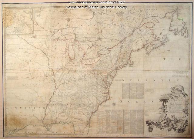
Map of the British and French North America, 1775
Contributed by: Maine Historical Society Date: 1755 Media: Ink on paper, map
Item 20763

Penobscot River and Chesuncook Lake, 1820
Contributed by: Maine Historical Society Date: 1820 Media: Ink on paper
Item 110898

St. Regis Village at the river St. Lawrence, New York, ca. 1815
Contributed by: Maine Historical Society Date: circa 1815 Location: Waverly Media: Ink on paper
Item 110905

Map of "Islands by Treaty of 1783," ca. 1817
Contributed by: Maine Historical Society Date: 1783 Media: Ink on paper
Item 110911

North Branch of the Meduxnekeag River, ca. 1817
Contributed by: Maine Historical Society Date: circa 1817 Media: Ink on paper
