LC Subject Heading: Maine--Maps--Early works to 1800
- Historical Items (34)
- Tax Records (0)
- Architecture & Landscape (0)
- Online Exhibits (0)
- Site Pages (0)
- My Maine Stories (0)
- Lesson Plans (0)
Historical Items
These results include photographs, documents, letters, paintings, artifacts, and many other kinds of Maine related items from collections around the state and elsewhere.
Item 9359

Maine, from the United States Gazetteer, 1795
Contributed by: Maine Historical Society Date: 1795 Media: Ink on paper
Item 9166

Contributed by: Maine Historical Society Date: 1795 Media: Ink on paper
Item 17126
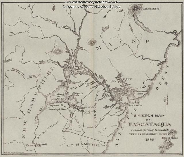
Sketch Map of Pascataqua, ca. 1690
Contributed by: Maine Historical Society Date: circa 1690 Media: Ink on paper, map
Item 10537

Contributed by: Maine Historical Society Date: 1717 Location: Brunswick Media: Ink on paper
Item 9165

Contributed by: Maine Historical Society Date: 1795 Media: Ink on paper, photonegative
Item 11454

Contributed by: Maine Historical Society Date: 1763-08-11 Location: Brunswick; Topsham Media: Ink on paper
Item 105628

Contributed by: Maine Historical Society Date: 1796 Media: Ink on paper
Item 116516

Extract from a Map of the British and French Dominions in North America, 1755
Contributed by: Maine Historical Society Date: circa 1755 Media: Ink on paper
Item 109025

Manuscript map of Topsham Lots, 1763
Contributed by: Maine Historical Society Date: 1763 Location: Topsham Media: Ink on paper
Item 10067

Contributed by: Maine Historical Society Date: circa 1780 Location: Gray Media: Ink on paper
Item 108753

Plan of the Bracket Lots, Androscoggin County, ca. 1800
Contributed by: Maine Historical Society Date: circa 1800 Location: Durham Media: Ink on paper
Item 109000

Dresden and Woolwich proposed border, ca. 1757
Contributed by: Maine Historical Society Date: circa 1757 Location: Woolwich; Dresden Media: Ink on paper
Item 110355

Survey of lots, Georgetown, 1793
Contributed by: Maine Historical Society Date: circa 1780 Location: Lubec Media: Ink on paper
Item 5960

Fort land for William Ross, Brunswick, ca. 1763
Contributed by: Maine Historical Society Date: circa 1763 Location: Brunswick Media: Ink on paper
Item 11714
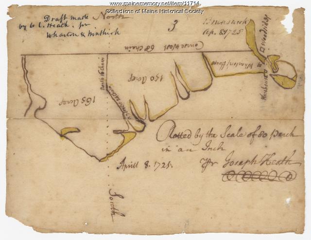
Contributed by: Maine Historical Society Date: 1725-04-08 Location: Brunswick Media: Ink on paper
Item 11715
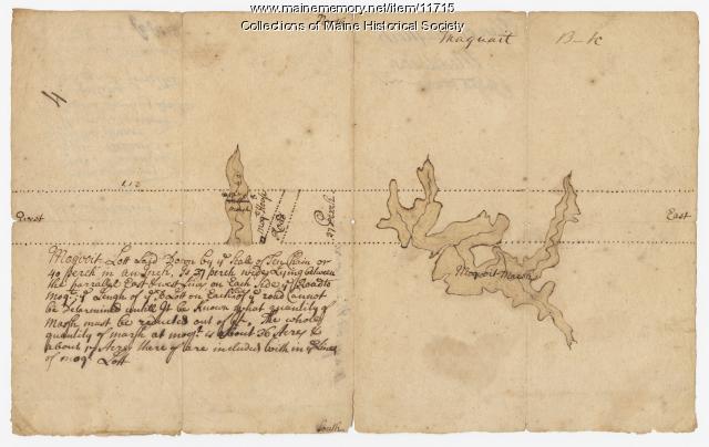
Plan of Maquoit Meadows, ca. 1720
Contributed by: Maine Historical Society Date: circa 1720 Location: Brunswick Media: Ink on paper
Item 11717

Contributed by: Maine Historical Society Date: circa 1718 Location: Brunswick; Harpswell; Bath; Topsham Media: Ink on paper
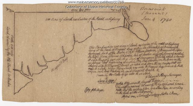
Item 11718

Contributed by: Maine Historical Society Date: circa 1740 Location: Brunswick Media: Ink on paper
Item 11719
Contributed by: Maine Historical Society Date: 1740-06-04 Location: Brunswick Media: Ink on paper
Item 11720

Contributed by: Maine Historical Society Date: 1740-09-29 Location: Brunswick Media: Ink on paper
Item 11721

Plan of Land at Brunswick Narrows, 1741
Contributed by: Maine Historical Society Date: 1741 Location: Brunswick Media: Ink on paper
Item 11722

Map of Brunswick, lots on Merrymeeting Bay, ca. 1750
Contributed by: Maine Historical Society Date: circa 1750 Location: Brunswick Media: Ink on paper
Item 11723

Contributed by: Maine Historical Society Date: 1747-07-06 Location: Brunswick Media: Ink on paper
Item 11724

Map of Brunswick near the Narrows, 1737
Contributed by: Maine Historical Society Date: 1737 Location: Brunswick; Topsham Media: Ink on paper
