Keywords: Documents
- Historical Items (690)
- Tax Records (0)
- Architecture & Landscape (63)
- Online Exhibits (65)
- Site Pages (192)
- My Maine Stories (16)
- Lesson Plans (26)
Site Pages
These sites were created for each contributing partner or as part of collaborative community projects through Maine Memory. Learn about collaborative projects on MMN.
Site Page
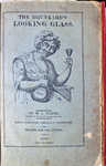
Rum, Riot, and Reform - Influential & Interesting Documents
"Influential & Interesting Documents Back to: 1620 to 1820: New England's Great Secret X The Drunkard's Looking Glass, ca."
Site Page
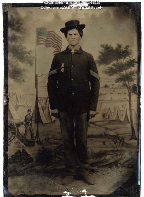
Maine and the Civil War - Regiments: Images, Documents
"Regiments: Images, Documents A few of Maine's more than 50 Civil War regiments and batteries are represented here."
Site Page
Malaga Island: a story best left untold - Maine State documents and Proclamations
"You can read the entire document below as well as listen to Herb Adams read this historic document into the record before the legislature."
Site Page

Beyond Borders - Mapping Maine and the Northeast Boundary - Pejepscot Proprietors Papers, 1627‐1866
"… such as “Indian captivity” depositions; documents pertaining to the Newburyport, Mass privateer Sea Flower; Revolutionary War documents; French…"
Site Page

"… Kennebec Proprietors, and so generated extensive documentation within its papers. Meanwhile, Martha gave birth to and mothered nine children…"
Site Page

"The Kennebec Proprietors maps document the continuance of Wabanaki people at Norridgewock, despite a persistent myth that Norridgewock was…"
Site Page

"But the task of writing about historical documents and making them relevant to non-historians is often daunting."
Site Page

Beyond Borders - Mapping Maine and the Northeast Boundary - Project Background
"26) each document the emergence of Maine as a unique and independent entity, distinct from British colonial rule, Massachusetts, the Canadian…"
Site Page

"One thing made clear in the documents and historic scholarship that reference these documents, is that the settlers are considered the heart of the…"
Site Page

"… and tribal scholars have turned to these documents for different kinds of evidence, including evidence of Wabanaki agency, kinship, leadership and…"
Site Page

"The documents produced by the border commission, particular early on, consistently highlight Passamaquoddy and wider Wabanaki Nations’ deep knowledge…"
Site Page

"Many of the documents were created and assembled to validate the holdings of the Pejepscot Proprietors, who in 1714 purchased rights originally…"
Site Page

"Many documents in these collections feature locations where multiple communities intersect, such as a deed that came late in Warrabitta’s life, at…"
Site Page

"… aboriginal right to hunt, fish and plant in their homelands. These documents collectively demonstrate that Wabanaki people intended to remain."
Site Page

Beyond Borders - Mapping Maine and the Northeast Boundary - Search the Collections
"… volunteers can continue to work on the remainder of the pages, and as they are approved the documents will be added to the transcription database."
Site Page

"… Society’s Thomas Barclay Collection that contains documents, land surveys, and maps dating from 1764 to 1893."
Site Page

Beyond Borders - Mapping Maine and the Northeast Boundary - Project Home
"The project documents European settlement of northern New England, specifically coastal and interior Maine, land distribution, and conflicts before…"
Site Page
"Such conflicts form a key context for the documents that visitors and researchers will encounter in the Beyond Borders portal."
Site Page

"Some of these documents were dubious or outright fraudulent. Other agreements had been signed by Wabanakis who sought to establish ongoing…"
Site Page

"Combined, these collections document a series of dreams—dreams of power, profit, and advancement, of imperial glory and patriotic achievement, of…"
Site Page

"… the king of the Netherlands with voluminous documentation, which informed his carefully-reasoned and pragmatic decision in 1831."
Site Page

"Indeed, as documents in the Barclay collection reveal, they were ultimately the basis on which the modern US-Canada border was determined."
Site Page

"This is outstandingly documented in the map of the interior canoe route between the St. John (Wolostoq) and Penobscot rivers that Chief Francis…"
Site Page
"… of all the essential treaties and many diplomatic documents related to the northeast boundary, such as the Royal Proclamation of 1763, the Quebec…"
