Keywords: county road
Item 10917

Wangon Road near Caribou, ca. 1895
Contributed by: Aroostook County Historical and Art Museum Date: circa 1895 Location: Caribou Media: Photographic print
Item 13624

White Settlement Road, Houlton, ca. 1890
Contributed by: Aroostook County Historical and Art Museum Date: circa 1890 Location: Houlton Media: Photographic print

Item 109336

Somerset County Cooperative Extension Service building, Skowhegan, 1977-1978
Contributed by: Maine Historical Society Date: 1977–1978 Location: Skowhegan Client: Somerset County Cooperative Extension Architect: Eaton W. Tarbell
Item 148395

Monkhouse residence boundary survey, Machiasport, 2002-2003
Contributed by: Maine Historical Society Date: 2002–2003 Location: Machiasport Client: Christoper P. Monkhouse Architect: CES, Inc.
Exhibit

Washington County Through Eastern's Eye
Images taken by itinerant photographers for Eastern Illustrating and Publishing Company, a real photo postcard company, provide a unique look at industry, commerce, recreation, tourism, and the communities of Washington County in the early decades of the twentieth century.
Exhibit

Construction of the Bangor and Aroostook rail lines into northern Aroostook County in the early twentieth century opened the region to tourism and commerce from the south.

Site Page
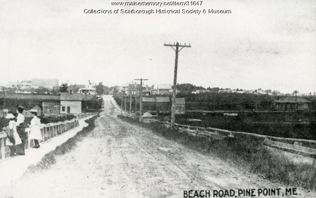
Scarborough: They Called It Owascoag - Roads: From Footpaths to Super Highway
"… was renamed the Post Road in 1760.(4) County Road and Saco Street, North Scarborough, 1907Scarborough Historical Society & Museum In the late…"
Site Page

Maine's Road to Statehood - Overview: Road to Statehood
"Additionally, towns in York County sought to remain part of Massachusetts because of their close proximity to Boston, while towns across the District…"

Story

Monument Square 1967
by C. Michael Lewis
The background story and research behind a commissioned painting of Monument Square.
Story

A Note from a Maine-American
by William Dow Turner
With 7 generations before statehood, and 5 generations since, Maine DNA carries on.
Lesson Plan

![]()
Becoming Maine: The Votes for Statehood
Grade Level: 3-5
Content Area: Social Studies
Maine became a state in 1820 after separating from Massachusetts, but the call for statehood had begun long before the final vote. Why did it take so long? Was 1820 the right time? In this lesson, students will begin to place where Maine’s statehood fits into the broader narrative of 18th and 19th century American political history. They will have the opportunity to cast their own Missouri Compromise vote after learning about Maine’s long road to statehood.
