Keywords: coastal maine
Item 15279

Coastal Artillery Corps companies, Fort McKinley, 1909
Contributed by: Maine Historical Society Date: 1909 Location: Portland Media: Photographic print
Item 102012

Colby family, Westport Island, ca. 1907
Contributed by: Westport Island History Committee Date: circa 1907 Location: Westport Island Media: Photographic print

Item 111492

CEI office center floor plan, Wiscasset, 1994
Contributed by: Maine Historical Society Date: 1994 Location: Wiscasset Client: Coastal Enterprises, Inc. (CEI) Architect: Carol A. Wilson; Carol A. Wilson, Architect
Item 116447

Brunswick Savings Institution, Brunswick, 1937-1945
Contributed by: Maine Historical Society Date: 1937–1945 Location: Brunswick Client: Brunswick Savings Institution Architect: John Howard Stevens and John Calvin Stevens II Architects

Exhibit

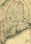
The boundaries of Maine are the product of international conflict, economic competition, political fights, and contested development. The boundaries are expressions of human values; people determined the shape of Maine.
Exhibit

Liberty Threatened: Maine in 1775
At Lexington and Concord, on April 19, 1775, British troops attempted to destroy munitions stored by American colonists. The battles were the opening salvos of the American Revolution. Shortly, the conflict would erupt in Maine.

Site Page
Cumberland & North Yarmouth - Population Decline in Maine's Coastal Counties
"Population Decline in Maine's Coastal Counties Maine in 1860 X Population swings Between 1790 and 1860, the population of Maine increased from…"
Site Page

Maine's Road to Statehood - The Final Vote
"As a result, any coastal opposition to separation could no longer be based on the hindrance of the former Coasting Law, and many who had previously…"
Story

30 years of business in Maine
by Raj & Bina Sharma
30 years of business, raising a family, & showcasing our culture in Maine
Story

What does a warming climate mean for Maine?
by David Reidmiller
Climate change affects all aspects of life. What does this mean for Maine?
Lesson Plan

![]()
Becoming Maine: The District of Maine's Coastal Economy
Grade Level: 3-5
Content Area: Social Studies
This lesson plan will introduce students to the maritime economy of Maine prior to statehood and to the Coasting Law that impacted the separation debate. Students will examine primary documents, take part in an activity that will put the Coasting Law in the context of late 18th century – early 19th century New England, and learn about how the Embargo Act of 1807 affected Maine in the decades leading to statehood.
