Keywords: Maps.
Item 105355

Contributed by: Osher Map Library and Smith Center for Cartographic Education Date: 1824 Media: Engraving
Item 11777

Contributed by: Maine Historical Society Date: circa 1905 Media: Ink on paper, map

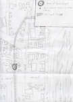
Item 109947

City of Portland and Harbor, Portland, 1870
Contributed by: Maine Historical Society Date: 1870 Location: Portland Client: unknown Architect: Olmsted Brothers
Item 109952

Outline map of properties known as Nimaha and Lyndonwood, Rockport, 1933-1936
Contributed by: Maine Historical Society Date: 1933–1936 Location: Rockport Client: unknown Architect: Olmsted Brothers

Exhibit

Colonial Cartography: The Plymouth Company Maps
The Plymouth Company (1749-1816) managed one of the very early land grants in Maine along the Kennebec River. The maps from the Plymouth Company's collection of records constitute some of the earliest cartographic works of colonial America.
Exhibit

Settling along the Androscoggin and Kennebec
The Proprietors of the Township of Brunswick was a land company formed in 1714 and it set out to settle lands along the Androscoggin and Kennebec Rivers in Maine.
Site Page

Farmington: Franklin County's Shiretown - Maps
"All the other maps were built on the base map. Farmington Base Map Farmington Agricultural Sites Farmington Cemeteries Farmington Cultural Interest…"
Site Page
Historic Hallowell - Train Wreck Map
"… Train Wreck Map Map X"

Story

Redlining and the Jewish Communities in Maine
by David Freidenreich
Federal and state policies created unfair housing practices against immigrants, like redlining.
Story

My career as a wildlife biologist
by Ron Joseph
Rural Maine provided the foundation of a rewarding career as a wildlife biologist.

Lesson Plan

Portland History: Mapping Portland, 1690 - 1900
Grade Level: 6-8
Content Area: Social Studies
Historical maps, like all historical documents, can be interpreted in many ways. This lesson plan uses five maps to trace the development of Portland from its earliest settlements.
Lesson Plan

Portland History: Lemuel Moody and the Portland Observatory
Grade Level: 3-5
Content Area: Social Studies
Lemuel Moody and the Portland Observatory Included are interesting facts to share with your students and for students, an interactive slide show available on-line at Maine Memory Network. The "Images" slide show allows students to place historical images of the Observatory in a timeline. Utilizing their observation skills students will place these images in chronological order by looking for changes within the built environment for clues. Also available is the "Maps" slide show, a series of maps from key eras in Portland's history. Students will answer the questions in the slide show to better understand the topography of Portland, the need for an Observatory and the changes in the landscape and the population centers.

