Contributed by Aroostook County Historical and Art Museum

- Item 22214
- print page
- download web image
Purchase a reproduction of this item on VintageMaineImages.com.
Description
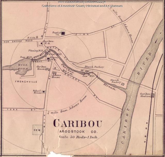
Roe and Colby map of Caribou showing the locations of: Baptist Church, saw mills, planing mill, grist mill, Adams House, starch factories, New Brunswick Railway, school house.
About This Item
- Title: Map of Caribou, ca. 1870
- Creator: Roe and Colby Company
- Creation Date: circa 1870
- Subject Date: circa 1870
- Location: Caribou, Aroostook County, ME
- Media: Ink on paper
- Dimensions: 15 cm x 16 cm
- Object Type: Text and Image
Cross Reference Searches
Standardized Subject Headings
Other Keywords
- Adams House
- Baptist Church
- grist mill
- map
- New Brunswick Railway
- planing mill
- Roe & Colby
- Roe and Colby Company
- saw mill
- school house
- starch factories
For more information about this item, contact:
Aroostook County Historical and Art Museum109 Main Street, Houlton, ME 04730
207-532-4216
Website
Use of this Item is not restricted by copyright and/or related rights, but the holding organization is contractually obligated to limit use. For more information, please contact the contributing organization. However, watermarked Maine Memory Network images may be used for educational purposes.
Please post your comment below to share with others. If you'd like to privately share a comment or correction with MMN staff, please send us a message with this link.
