Contributed by City of Portland Dept. of Public Works

- Item 11963
- print page
- download web image
Purchase a reproduction of this item on VintageMaineImages.com.
Description
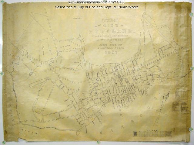
Map entitled, "Plan of the City of Portland from a survey made under the direction of the City Council by James Hall, C.E. Drawn by W.L. Dearborn & T. Quinby, 1837. This map shows Maine Street (now Congress), the Cumberland and Oxford Canal, the City Farm, and many other locations on the peninsula. An index to places of interest is included.
About This Item
- Title: Plan of the City of Portland, 1837
- Creator: James Hall
- Creation Date: 1837
- Subject Date: 1837
- Location: Portland, Cumberland County, ME
- Media: Ink on paper, map
- Dimensions: 69 cm x 91 cm
- Local Code: 50/2
- Object Type: Text and Image
Cross Reference Searches
Standardized Subject Headings
- Cumberland and Oxford Canal (Me.)--Maps
- Portland (Me.)--Maps
- Congress Street (Portland, Me.)--Maps
- Canals--Maine
- City Farm (Portland, Me.)
Other Keywords
For more information about this item, contact:
City of Portland Dept. of Public Works55 Portland Street, Portland, ME 04101
(207) 874-8837
Website
Use of this Item is not restricted by copyright and/or related rights, but the holding organization is contractually obligated to limit use. For more information, please contact the contributing organization. However, watermarked Maine Memory Network images may be used for educational purposes.
Please post your comment below to share with others. If you'd like to privately share a comment or correction with MMN staff, please send us a message with this link.
