Contributed by Maine Historical Society

- Item 10763
- print page
- download web image
Purchase a reproduction of this item on VintageMaineImages.com.
Description
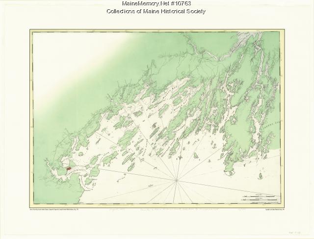
The Atlantic Neptune, nautical charts of the Atlantic coast by Joseph F. W. Des Barres, was published in about 1776. It is divided into four series: Nova Scotia, New England, the River and Gulf of St. Lawrence, and New York Southward.
This map was created by Maine Historical Society using the two sheets of the Chart of Casco Bay from the New England series. These were reduced in size and pieced together with modern color added to create this single-sheet map.
About This Item
- Title: Chart of Casco Bay from the Atlantic Neptune, 1776
- Creator: Joseph F.W. Des Barres
- Creation Date: 1997
- Subject Date: circa 1776
- Location: Casco Bay, ME
- Media: Ink on paper, map
- Dimensions: 58 cm x 77 cm
- Local Code: Map F 539
- Object Type: Text and Image
Cross Reference Searches
Standardized Subject Headings
- Casco Bay (Me.)--Maps-Early works to 1800
- Casco Bay (Me.)--Nautical charts
- Des Barres, Joseph F. W. (Joseph Frederick Wallet), 1722-1824
- Early maps--Facsimiles
- Nautical charts--Atlantic Coast (North America)-Early works to 1800.
For more information about this item, contact:
Maine Historical Society485 Congress Street, Portland, ME 04101
(207) 774-1822 x230
Website
This Item is protected by copyright and/or related rights. No Permission is required to use the low-resolution watermarked image for educational use, or as allowed by the applicable copyright. For all other uses, permission is required.
Please post your comment below to share with others. If you'd like to privately share a comment or correction with MMN staff, please send us a message with this link.
